Paddle Florida®
Over 100 Florida Paddling Destinations
E-Z Maps... Photos... Reports...
You are here > Home >
East-Central FL >
Black Water Creek-Seminole State Forest
Latest update: May 2021
Black Water Creek in Seminole State Forest, FL...
Scenic and Secluded (Use Permit Required)
Black Water Creek flows from Lake Norris (in Lake County) for about 20 miles to the Wekiva River. Here we report on a portion of the creek within the Seminole State Forest. Unlike nearby Wekiva State Park or Rock Springs Run, there are no crowds - a pristine and quiet area that is a great wilderness escape. A State Forest Use Permit with gate code is required for drive-in access (e-mailed after a phone call to State Forest Office, 352-360-6675). (Detailed map, photos below.) Note: A few miles upstream, the Creek becomes impassable. It opens up again just below the hand-launch on Black Water Creek at Lake Norris (link below).
Distance: Varies, per water levels and downfall. 3-4 miles upstream,
8 miles downstream to take-out on St Johns at Highbanks Marina.
Location: Lake County
Difficulty: Easy to moderate
Tidal: No
Launch points: Wekiva River Road in the Seminole State Forest (See
map)
Nearby points of interest: Wekiva State Park,
Kelly Park, Mt. Dora
Rentals/Outfitters/Tours:
N/A
Page Summary:
- Paddling at Black Water Creek in Seminole State Forest
- Bear Creek Trailhead to Launch
- Downstream from Launch
- Upstream from Launch - Wildlie
- About Seminole State Forest
- More Information and Resources
Paddling at Black Water Creek in Seminole State Forest... Comments and Photos
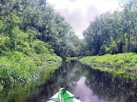
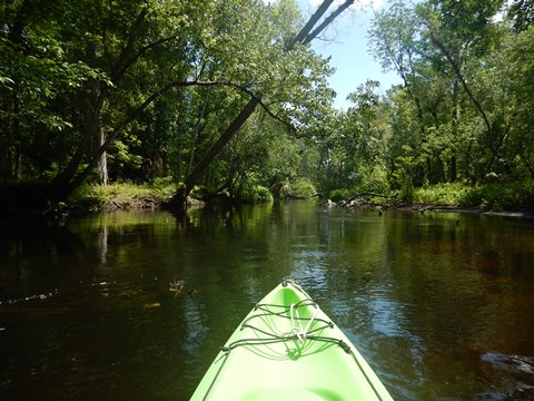
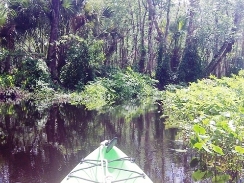
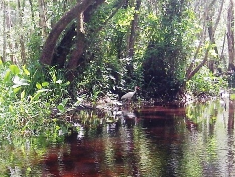
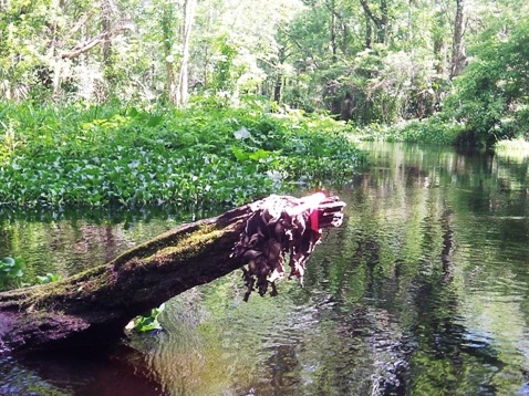
We enjoy the simplicity of out and back kayaking and here Black Water Creek is a perfect location - scenic solitude, no gasoline motors allowed! On various trips, we've paddled from the launch both upstream and downstream and returned. This is a tannic water creek, too dark to see anything in the water. There are few people, so wildlife remains wild. Birds flew away as we approached. We saw many alligators and turtles, but most slipped into the water before we could get a photo. On the other hand, we encountered something we don't recall ever seeing before on a Florida river or creek... not one piece of trash!
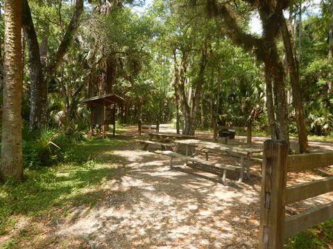
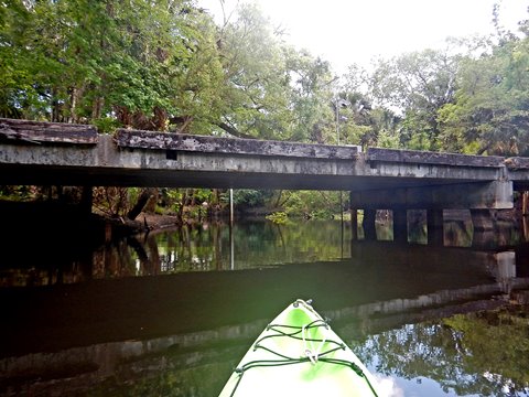
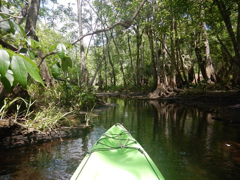
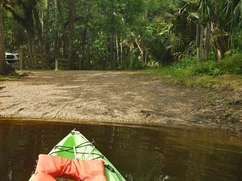
Bear Creek Trailhead to Launch
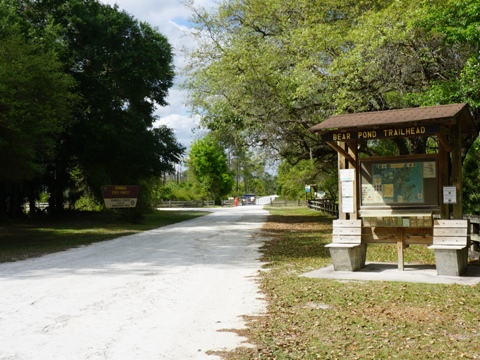
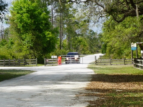
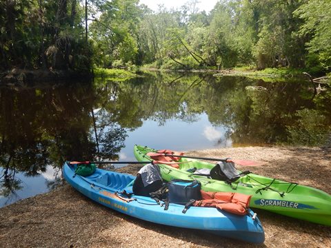
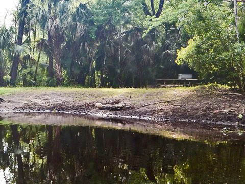
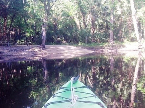
We obtained a permit (with gate lock code) and entered the State Forest from the Bear Pond Trailhead off SR46 (remembering to lock the gate behind us). Note: The same code also works from the Cassia Trailhead off SR44. From Bear Pond, it's about two miles on hard-packed forest road to the launch, on the left just after crossing the bridge over Black Water Creek. The shaded day-use area at the launch has picnic tables and grill, no other amenities (restrooms are available at the Bear Pond and Cassia Trailheads). Parking is limited, 2 vehicles max; more parking is at an intersection located about 300 yards north. Few other vehicles are usually seen at the launch area, especially on weekdays. The hand-launch is easy on and off - no gasoline motors allowed.
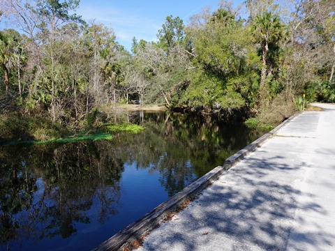
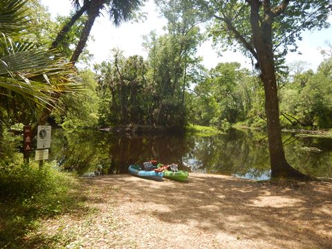
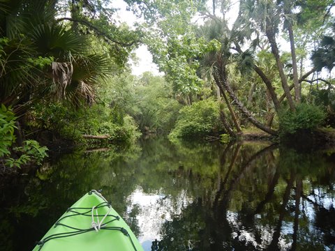
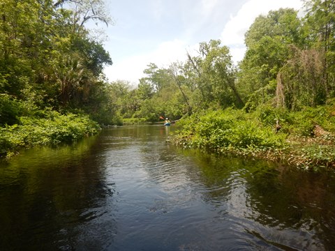
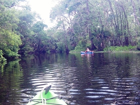
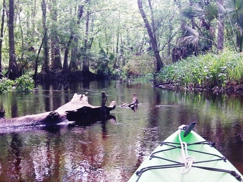
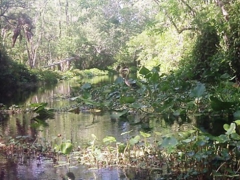
Black Water Creek - Downstream from Launch
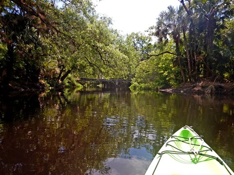
From the launch, go under the road bridge to proceed downstream. We enjoy paddling out and back, but a popular trip with outfitters is 8 miles (one way) downstream, about 4.5 miles to the Wekiva River - then another 3.5 miles on the St. Johns River to the takeout at Highbanks Marina. This route is maintained by the State Forest Service, but the first 4 miles (in mostly dense forest) are always subject to newly downed trees. On this trip, we paddled about 2 miles downstream and back (4 miles RT). The creek was open and mostly easy navigating around a few obstacles. We took a look at Sulphur Run, a 3.5 mile spring run, but we paddled only a very short distance here before being stopped by debris (low water on this trip). Overall, a relaxing trip in shady solitude.
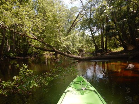
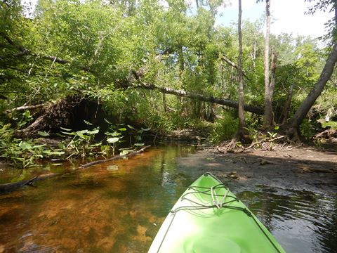
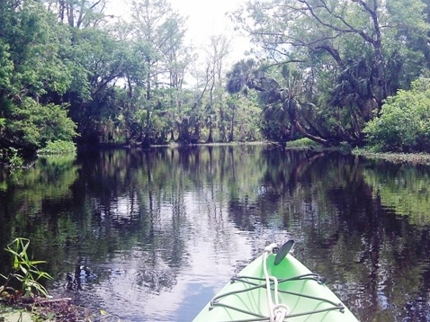
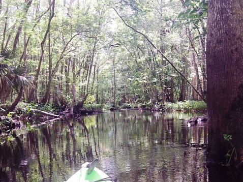
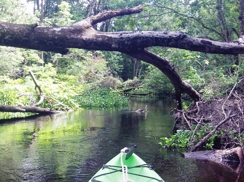
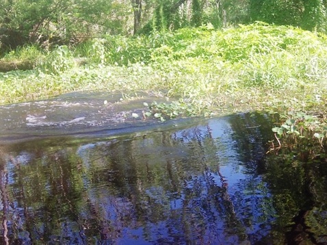
Black Water Creek - Upstream from Launch
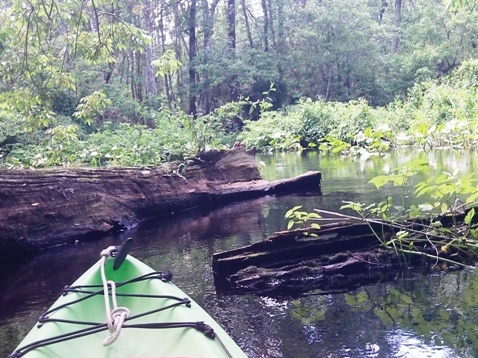
On this trip we launched and paddled upstream about 3.5 miles, stopping at Moccassin Spring Campsite, and then floated back to the launch, quiet and beautiful - we didn't want it to end. Lots of tree canopy here. As you go upstream, paddling becomes more technical - increasingly more narrow, shallow, and twisting. We encountered some downed trees making passage tricky, but no pull-overs! The trees were cut just enough. After about 3 miles upstream, the creek is about half as wide as it is at the launch and the depth is only about 1-2 feet or less. With 12' sit-on-top kayaks, this is the kind of water we really enjoy. We could see where trees were cut, but after a storm, don't count on it not being blocked by new downfall. We could have gone a little further upstream, but it was getting late, so we turned back to beat the bugs.
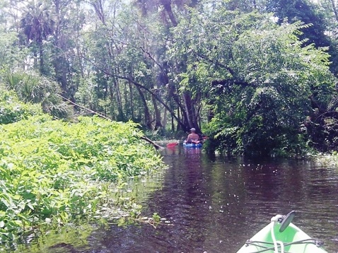
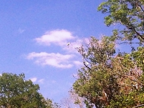
Wildlife
The Seminole State Forest includes many natural communities, with endangered species such as the scrub jay and Florida black bear. This is part of the Great Florida Birding and Wildlife Trail. There must be very few paddlers here - especially upstream, because here the wildlife remains truly wild. All the alligators and even the turtles slipped into the water immediately upon spotting us. Disappointing at first, but then came the thrill knowing that such a place still exists in Central Florida.
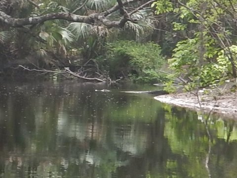
Coming around a bend, we startled an alligator on the shore - big splash! Not sure who was more startled. No time to get a photo, but here are the ripples (watch 10 sec. video).
About Seminole State Forest
Seminole State Forest covers more than 27,000 acres plus 1,725 acres of sand pine scrub, an important ecosystem protected in the forest. Activities include camping, hiking, biking, paddling, horseback riding, hunting and fishing. The Wekiva River Preserve forms the Forest's eastern border, Black Water Creek flows through it, plus there are numerous springs (Moccasin and Shark's Tooth Springs being the most notable), and a 7.5 mile segment of the Florida National Scenic Trail. Pay a per person day-use fee.
More Information and Resources
Nearby Paddling:
Black Water Creek Overview
Black Water Creek at Lake Norris
Wekiva River
Rock Springs Run
See FL East-Central Region
for more paddling
Nearby Biking:
Eco-biking and hiking at Seminole State Forest at www.100FloridaTrails.com
Additional Resources:
Florida Forest Service -
Seminole State Forest
Florida Forest Service - Black Water Creek Interpretative Paddle
Guide (.pdf)
A special thanks to our State Forest Service employees and volunteers who work to keep both sections Black Water Creek open.
View great paddling by FL Region or Listed A - Z

PaddleFlorida.net... Find Florida's Best Recreational Paddling,
by Kayak, Canoe, and Paddleboard too.
Copyright © PaddleFlorida.net. All Rights Reserved. Paddle Florida®