Paddle Florida®
Over 100 Florida Paddling Destinations
E-Z Maps... Photos... Reports...
You are here > Home >
West Central Florida >
Withlacoochee River
Latest update: August 2022
Withlacoochee River, Florida (South)...
Kayaking an Outstanding Florida Waterway
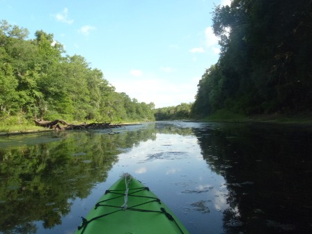
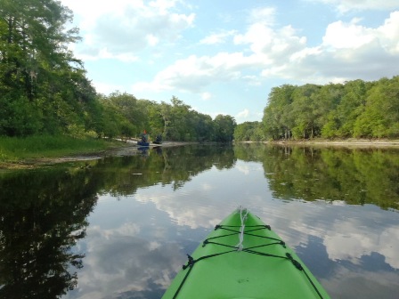
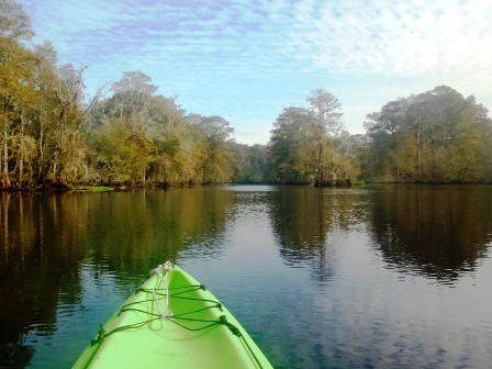
Withlacoochee River (South), a designated "Outstanding Florida Waterway" is a blackwater river originating in the Green Swamp. The river then flows 141 miles northwest to the Gulf of Mexico at Yankeetown, with a 76-mile Designated Paddling Trail mapped from Lacoochee to Dunnellon. There is some development along the banks, but in the river's southern section (below Nobleton), much of the river flows through State Forest and Conservation Areas. Quiet, scenic, sheltered (wind, sun, usually no motorboats), this is the type of kayaking we enjoy most. Heading north, motorboats increase as the river widens. Note: There are two Withlacoochee Rivers in Florida - the Withlacoochee River (North) originates in Georgia and flows into the Suwannee near Suwannee River State Park. (Detailed map, photos below.)

Distance: 76 mile designated trail (Lacoochee to Dunnellon);
141 miles total
Location: Pasco, Hernando, Sumter, Citrus, Marion Counties
Difficulty: Easy to Moderate
Tidal: Not on designated trail. Yes approaching Gulf
Launch points: Lacoochee Park, CR 575 bridge, Silver Lake
Recreation Area, Hog Island Recreation Area, Nobleton Wayside Park, Lake Townsen
Regional Park, Centennial Park, others (See map)
Nearby points of interest: Fort Cooper State Park, Brooksville,
Withlacoochee State Trail
Rentals/Outfitters/Tours:
Easy Peasy Mobile Kayak Rental
(Mobile: kayak / paddleboard rental, pickup / delivery including campsites & Airbnb)
Rainbow River Canoe & Kayak
(Dunnellon: rentals, shuttle)
River Ratz at Nobleton Outpost
(Nobleton: rentals, shuttle)
Support and Advocacy:
Page Summary:
- Padding the Withlacoochee River
- South (Upper River) Section: Lacoochee to
Hog Island
- Lacoochee, Silver Lake, Little Withlacoochee River, Iron Bridge, Hog Island, Wildlife - Middle Section: Near Lake Panasoffkee
- Marsh Bend "Outlet" County Park, Carlson Landing/Wysong Dam, Rutland Park - End of Designated Paddling Trail
- Upstream from Dunnellon and Return - North (Lower River) Section: Dunnellon to the Gulf
- Goldendale Boat Ramp, Lake Rousseau/Inglis Dam and Recreation Area
- Cross Florida Barge Canal, Inglis Bypass Canal, Bird Creek Landing - More Information and Resources
Padding the Withlacoochee River, FL... Comments and Photos
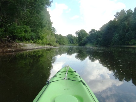
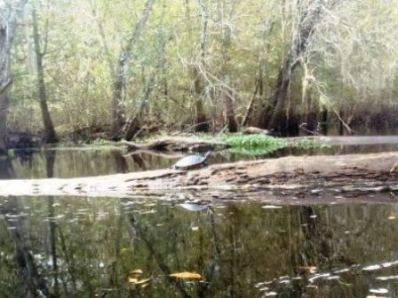
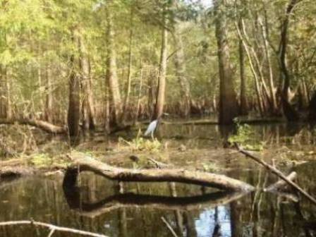
The river originates in the Green Swamp and then flows north through the Withlacoochee State Forest. Water levels can fluctuate greatly depending on rainfall. The Designated Paddling Trail starts at CR 575 (Lacoochee Park) and travels west and north to Dunnellon (Centennial Park at US 41 bridge). Rainbow River feeds into the Withlacoochee just before Dunnellon. West of Dunnellon (beyond the Paddling Trail), the river passes through Lake Rousseau, formed by a dam in the early 1900's. It then continues west to the Gulf of Mexico. In addition to paddling, recreational activities include hiking, biking, camping, picnicking, fishing, wildlife viewing, bird watching, and horseback riding.
Our South (Upper River) and Middle Sections include the Designated Paddling Trail, while our North (Lower River) Section goes beyond the trail to the Gulf. We enjoy kayaking in several areas, and visited launches in other areas - descriptions and photos below.
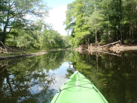
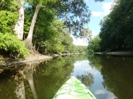
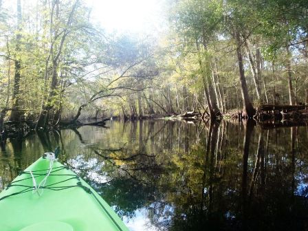
South River Section - Lacoochee to Hog Island
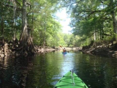
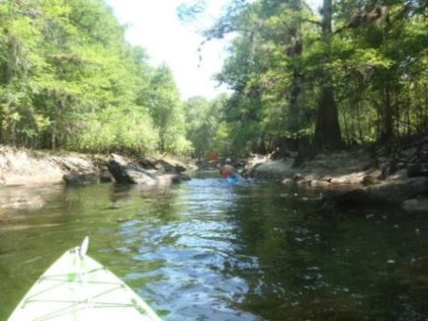
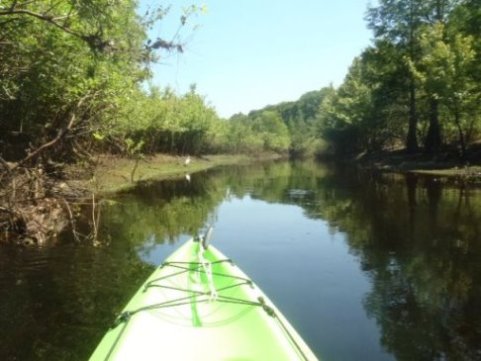
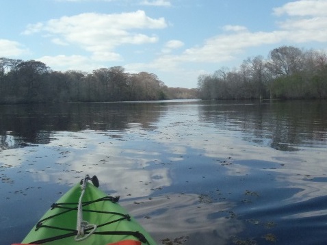
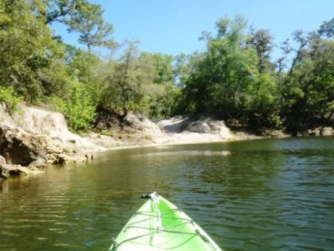
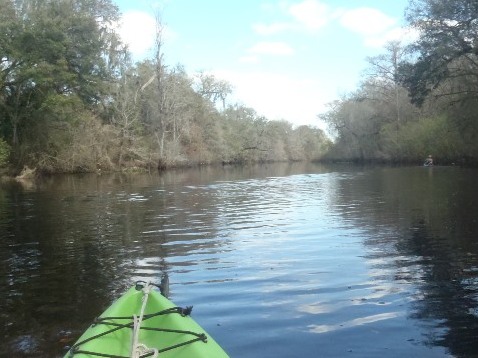
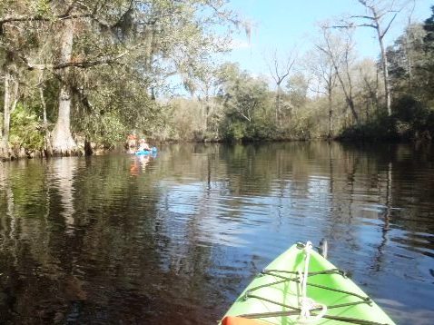
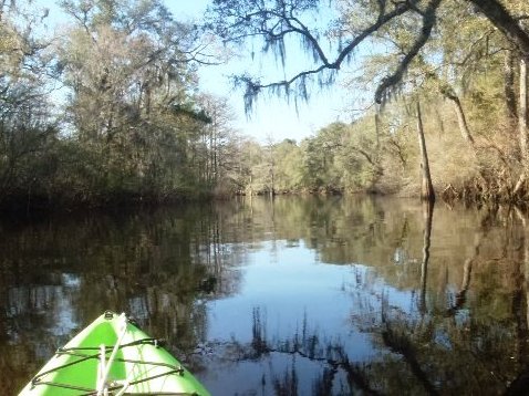
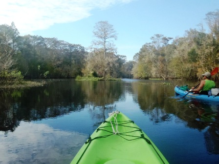
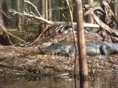
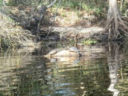
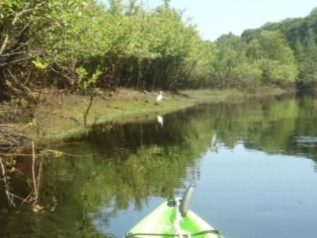
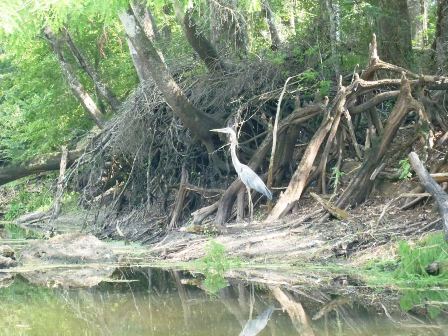
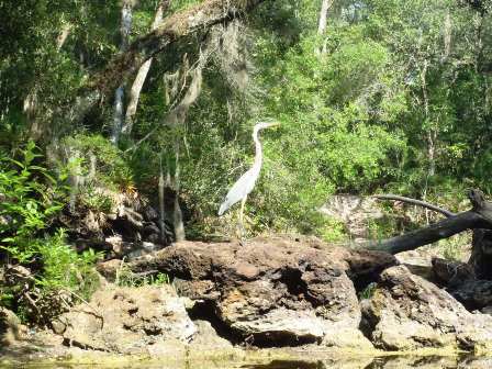
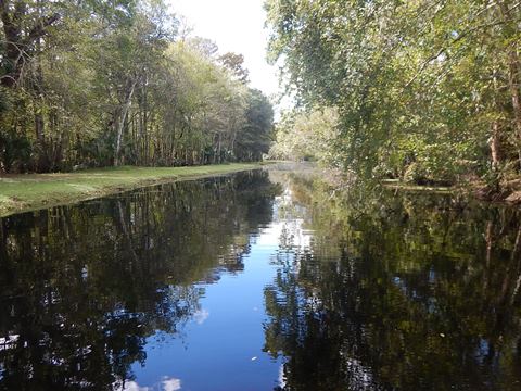
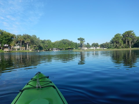
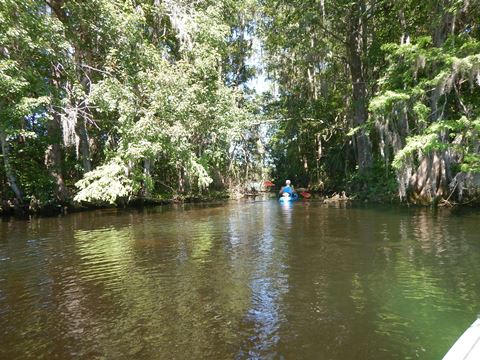
For recreational paddling, we like the river south of Nobleton, FL, where it is the smallest and most natural - upstream from CR 575 into the State Forest for as far as water levels allow, and downstream from CR 575 through Silver Lake and past Hog Island to the town of Nobleton. Other than on Silver Lake, few if any motorboats are encountered on this southern-most part of the Withlacoochee River, especially at low water. The Designated Paddling Trail starts here.
CR575 - Lacoochee (mile 2.5)
Paddling Upstream into State Forest and Return
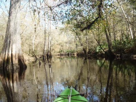
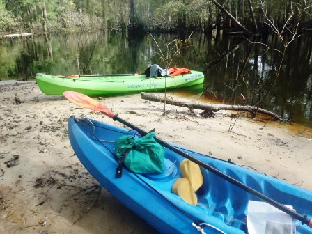
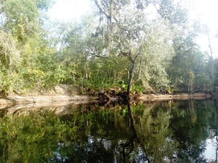
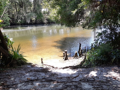
From Withlacoochee River Canoe Rental (CR575 at Lacoochee), paddling upstream. There was plenty of clean, sand river bank heading upstream.
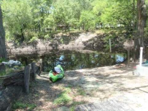

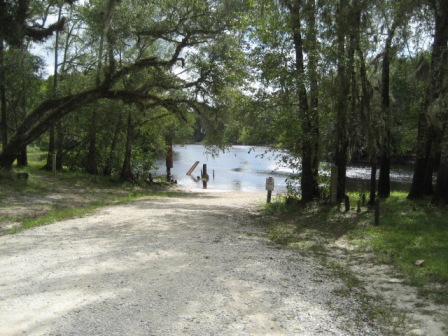
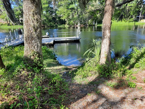
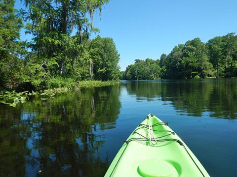
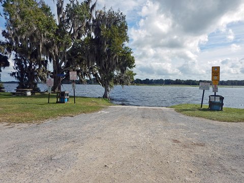
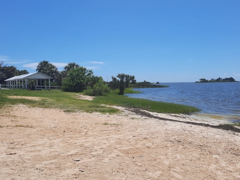
Silver Lake (mile 19)
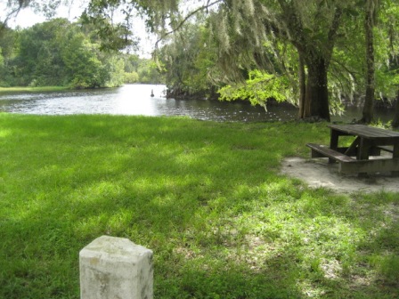
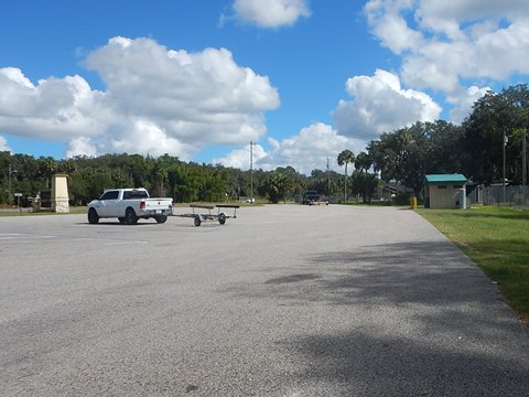
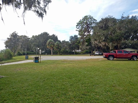
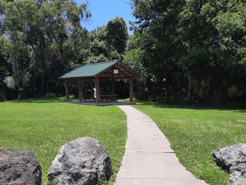
Silver Lake Recreation Complex
Silver Lake Recreation Complex has parking, picnic pavilion, fishing, hiking trails, boat/kayak/canoe launch, and campground.

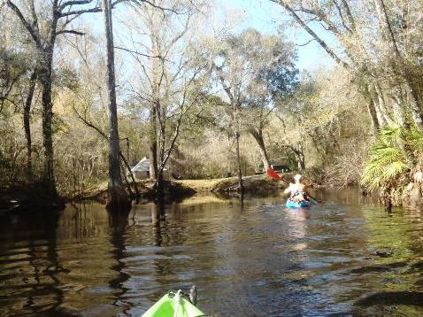
Upstream from Silver Lake
From the launch at CR60 at the south end of Silver Lake, paddling upstream. At the launch area are parking, swimming, fishing, and picnicking. On different trips, we saw a big difference paddling at low water (wide banks, places to pull off) vs. high (fewer places to pull off).
Low Water


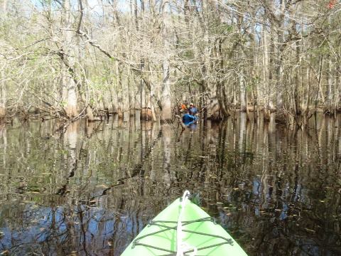
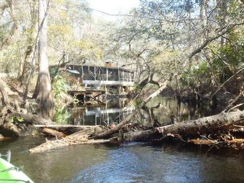
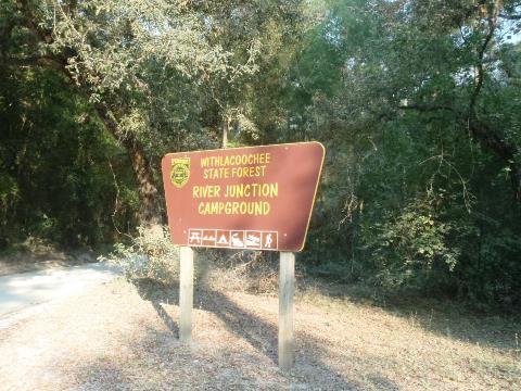
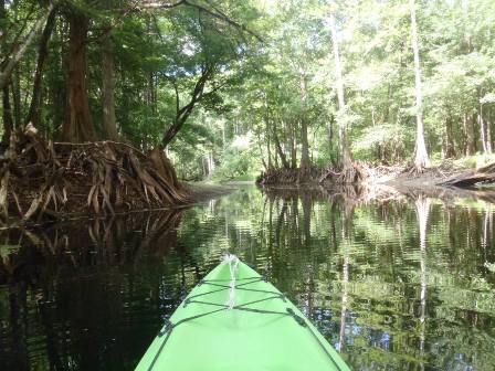
Little Withlacoochee River
The Little Withlacoochee joins the main river near Silver Lake (about 4/10 mile upstream). River Junction Recreation Area has a landing, picnicking, campground, restrooms. A more technical paddle; we paddled at high water, but can be non-navigable at low.
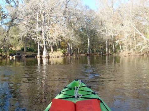
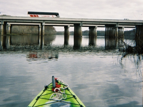
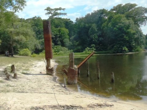
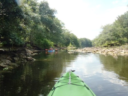
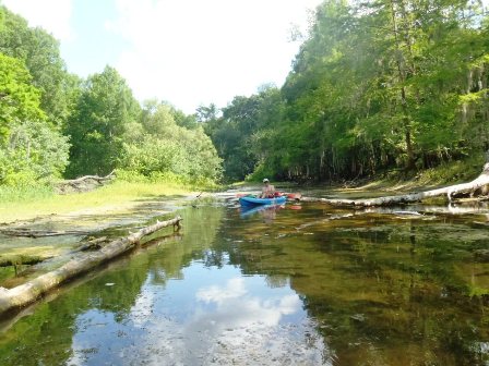
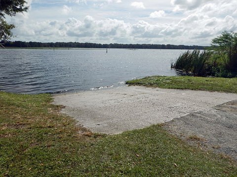
Iron Bridge (mile 20)
We launched at Iron Bridge, paddling both upstream and down from the launch. We paddled during low water, so there were many places to land but we also were stopped by shallow water and had to turn around. The Iron Bridge Day Use Area has parking, kayak/canoe launch, picnicking, and hiking.
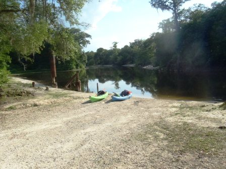
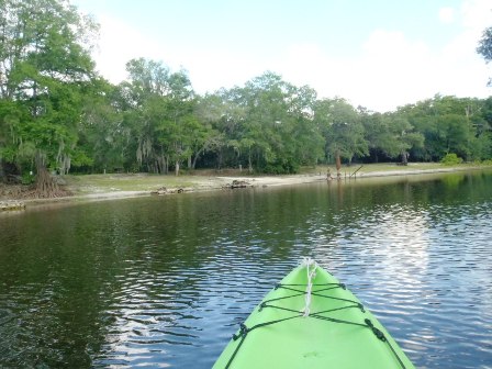
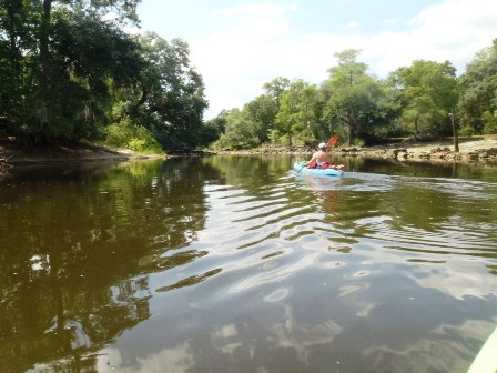
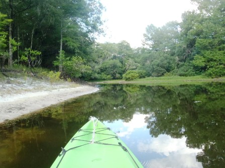
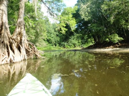
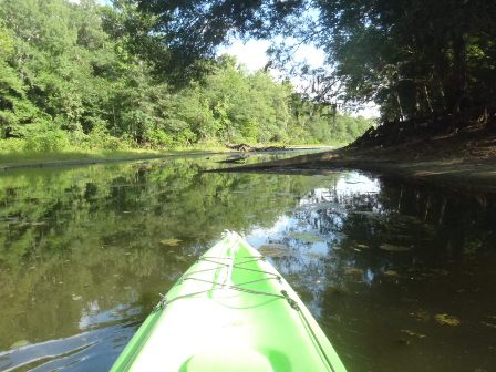
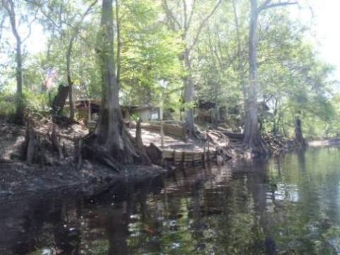
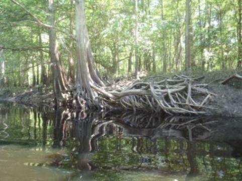
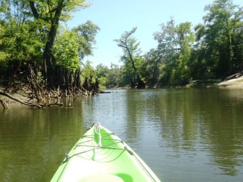
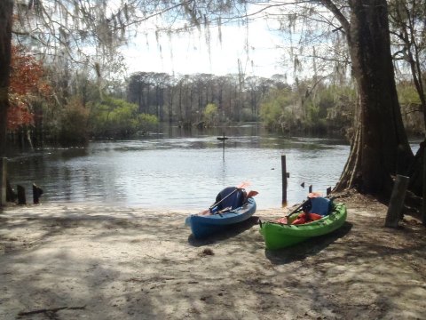
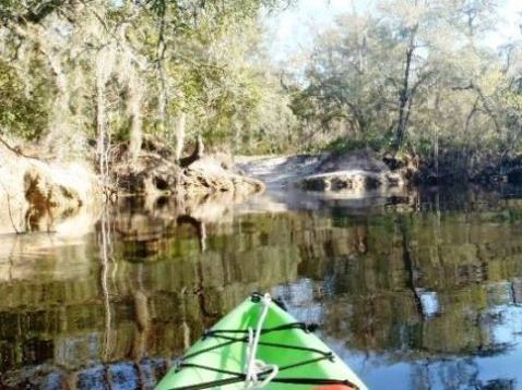
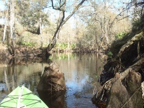
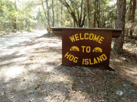
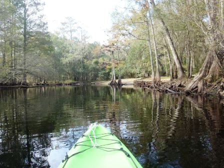
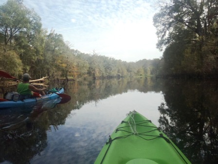
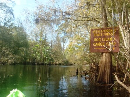
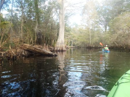
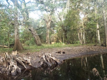
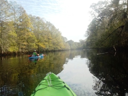
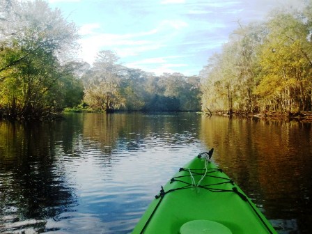
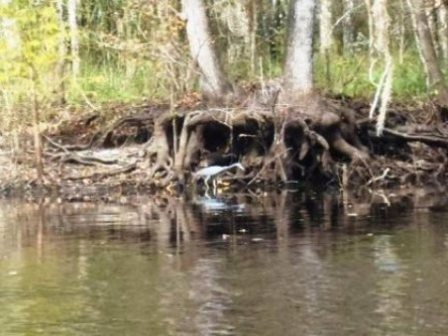
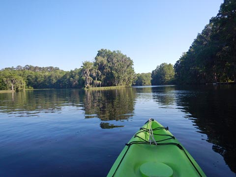
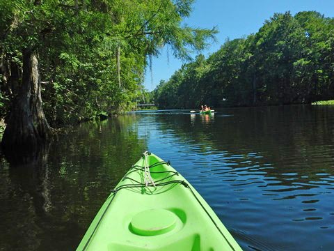
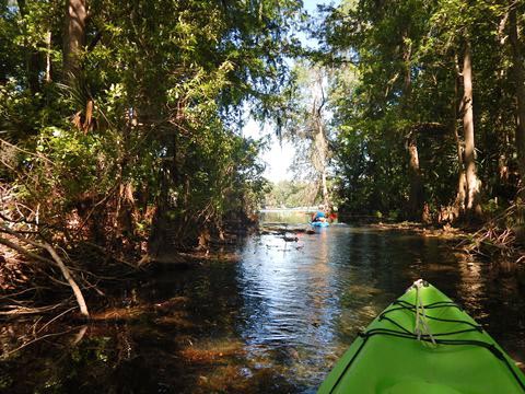
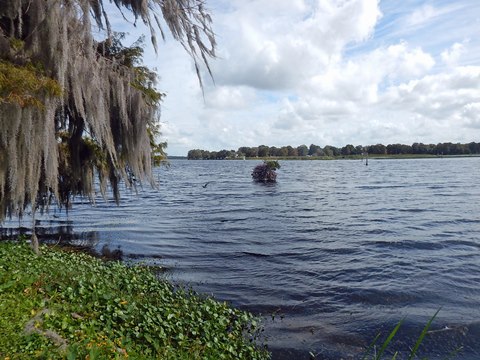
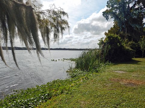
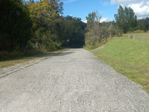
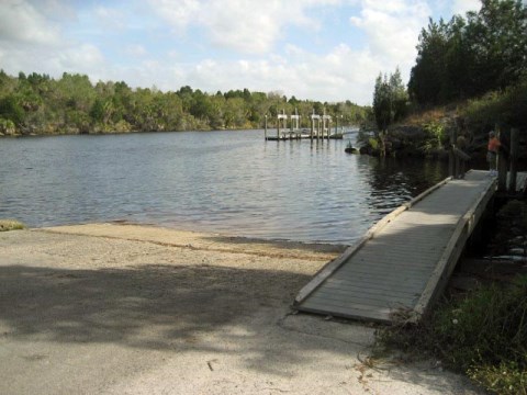
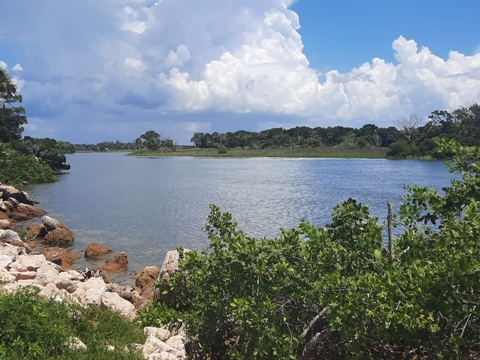
Hog Island (mile 21.5)
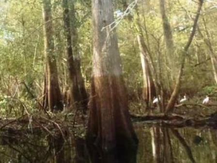
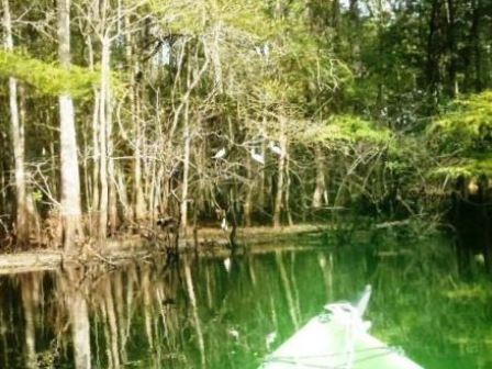
We launched at the Hog Island Recreation Area, south of Nobleton. The river splits here and circles Hog Island, a nice paddling trip. We then paddled upstream. This is a very pretty area, through cypress forest - but few places to stop and stretch. The Hog Island Recreation Area has parking, picnicking, hiking and equestrian trails, boat/kayak/canoe launch, and a campground.
Launch

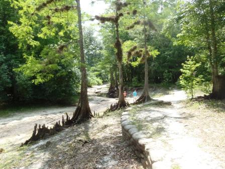


Paddling Around Hog Island


Middle River Section near Lake Panasoffkee
Lake Panasoffkee is a 4,450 acre Fish Management Area at the town of Panasoffkee. A natural spring-fed lake, it's renowned for fishing. It connects to the Withlacoochee via Outlet River (2 miles). Part of the Designated Paddling Trail.
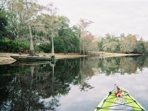
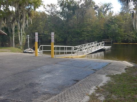
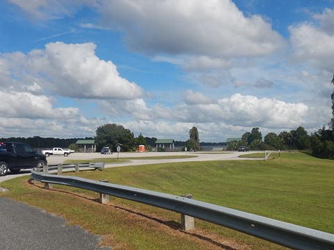
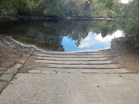
Marsh Bend "Outlet" County Park (mile 42)
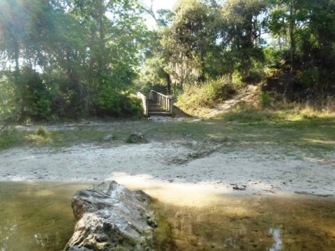
The park is off the Withlacoochee, about a mile along the Outlet River running between the Withlacoochee and Lake Panasoffkee. The park has a double boat ramp, parking, restroom, picnicking, playground, hiking trails. Canoe rentals available. Grassy area next to the ramp is an easy launch.


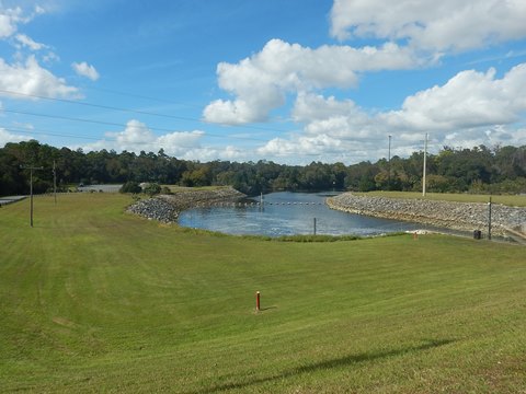
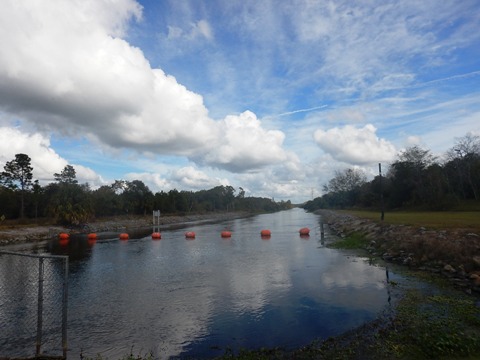
Carlson Landing / Wysong Dam (mile 45)
2 single lane boat ramps are at Wysong Park - one on either side of the lock, portage between the two (about 200 feet). We visited the upstream side. Parking, no other amenities. The Wysong-Coogler Dam was constructed in 1965 to help maintain water levels on Lake Panasoffkee and the Tsala Apopka chain of lakes.
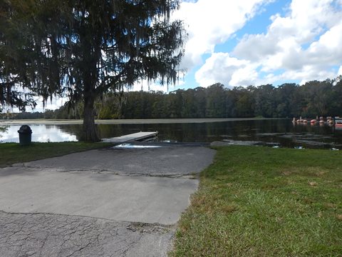
Rutland Park (mile 47.5)
The Rutland Park Boat Ramp is along SR 44 at the Withlacoochee River bridge. Double boat ramp, parking, restrooms, picnicking. Grassy areas next to the ramps are an easy launch. A canal leads to the river, about 2/10 mile.

End of Designated Paddling Trail
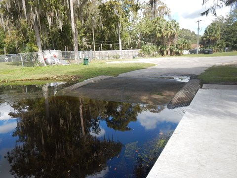
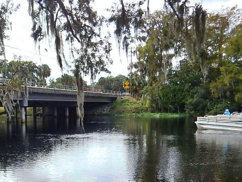
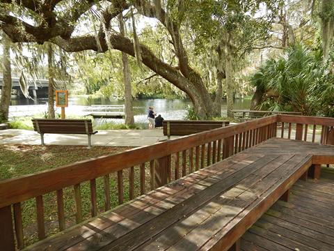
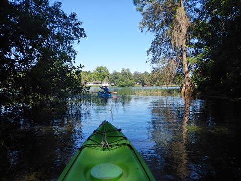
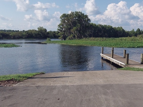
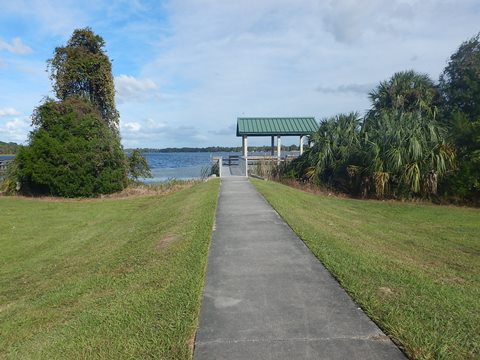
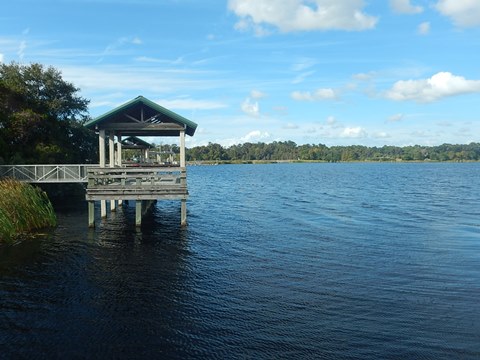
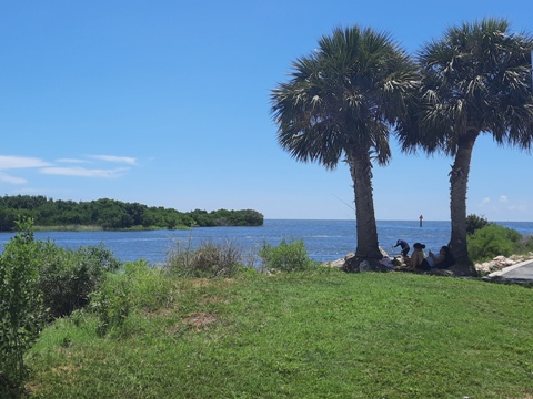
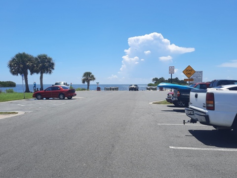
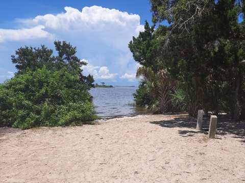
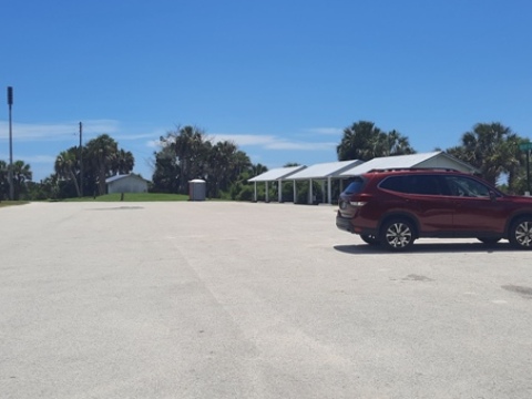
Centennial Park (mile 76)
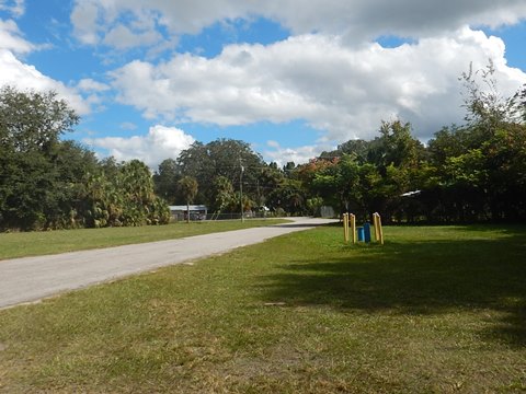
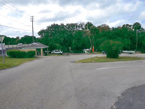
Just below the confluence with the Rainbow River, the Designated Paddling Trail ends at Centennial Park in Dunnellon, next to City Hall at the US41 (N. Florida Ave.) bridge. Centennial Park has parking, picnicking, restrooms, and a boat ramp. Dunnellon provides accommodations, food, shopping.


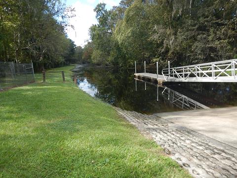
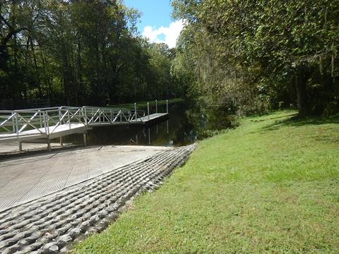
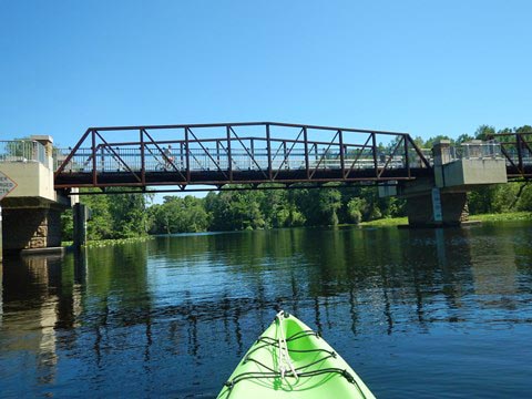
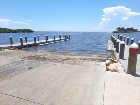
Upstream from Dunnellon and return
(about 2 miles round-trip)
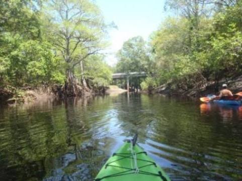
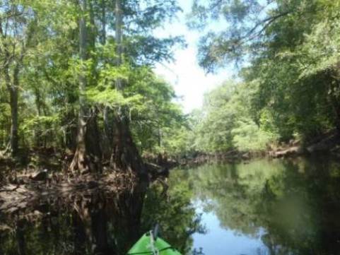
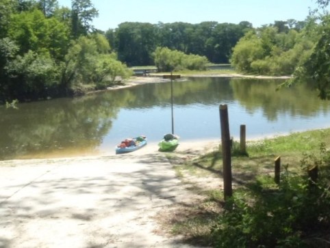
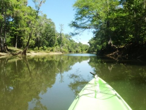
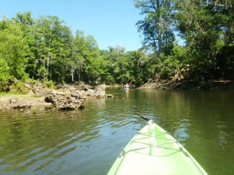
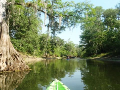
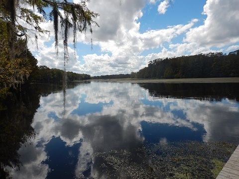
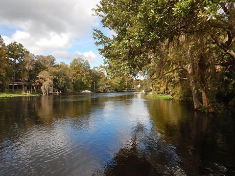
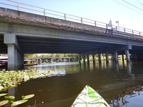
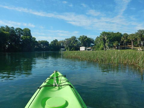
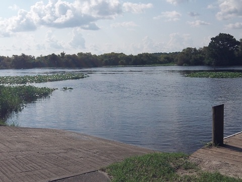
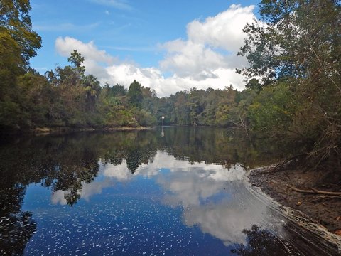
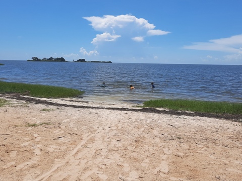
There are two options for launching: at the boat ramp is a sandy area to launch from, or to the right of the ramp is a grassy area with a short drop to the water. We paddled upstream from Centennial Park, under US41 and a railroad bridge, passing the juncture with the Rainbow River (about 1/2 mile) and continuing to just past the Dunnellon Trail Bridge (1/2 mile) and return. The river here runs through natural, undeveloped areas paralleling the Marjorie Harris Carr Cross Florida Greenway. Rainbow Springs State Park and the Rainbow River are the highlight here for paddlers, while the bicycle bridge over the Withlacoochee is a notable feature on the Dunnellon Trail, a segment along the Cross Florida Greenway. On our return, we noticed a cut through the trees and decided to explore - it was a "short cut" to the Rainbow River, so we returned along the Rainbow River back to the juncture.
Upstream from Dunnellon


North River Section - Dunnellon to the Gulf
Past Dunnellon, the river is interrupted at Lake Rousseau and the Inglis Dam and requires a shuttle to continue (or finish up on the Cross Florida Barge Canal to the Gulf).
Goldendale Boat Ramp
About 3 river miles past Dunnellon, Goldendale Boat Ramp on the south side of the river is a convenient stop en route to Lake Rousseau. Parking, boat ramp, fishing pier. No other amenities. Watch for airboats.
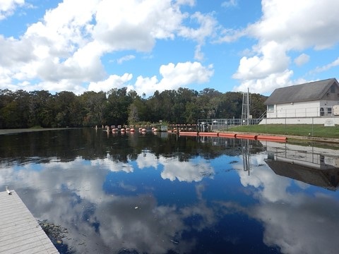
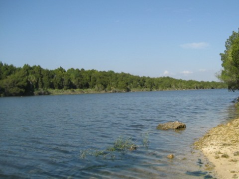
Lake Rousseau - Inglis Dam and Recreation Area
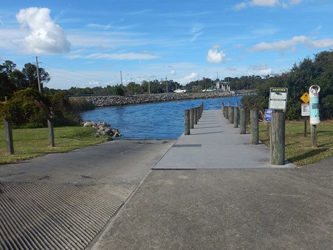
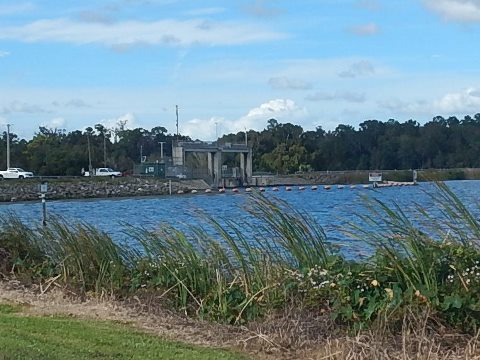
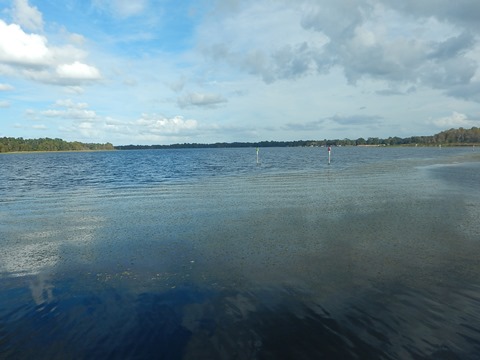
Continuing west (downstream) the river passes through Lake Rousseau (12 miles long, 3,700 acres), formed when Inglis Dam was built in the early 1900's to provide hydroelectric power to the phosphate mining industry driving the local economy at the time. It later was incorporated into the ill-fated Cross Florida Barge Canal in the 1960's. Today, the lake is popular for fishing. There are many underwater stumps - if boating, keeping in the channels is recommended. Boat and paddle in the lake on the upstream side of the dam, or on the Withlacoochee River and Cross Florida Barge Canal below the dam. The lock has been inoperational since 1999 and the river is closed off at the Canal, so there's no easy way to continue on the Withlacoochee. If you do want to finish on the Withlacoochee to the Gulf, use a shuttle to pick up the river downstream.
Lake Rousseau Boat Ramp - Inglis
On the north side of the river at the east end of Lake Rousseau, off SR40 and then about a mile to the ramp on SE 116th Ave. Parking, ramp, picnic table, no other amenities. Popular with fishermen.

Lake Rousseau Boat Ramp - Inglis Dam
At the western end of Lake Rousseau in the Inglis Dam Recreational Area Dessie Smith Prescott Memorial), on W. Riverwood Drive east of US19. Parking, boat ramp, restrooms, picnicking, 3 fishing piers. The dam here blocks off the Withlacoochee. The Recreational Area has numerous recreational options including biking, hiking, picnicking, boating, fishing, and horseback riding. It's part of the Cross Florida Greenway (see biking links, below).
Lake Rousseau to Gulf
Two options to continue to the Gulf: (1) on the Cross Florida Barge Canal, or (2) on the river from Inglis Canal Bypass
Ramp - Withlacoochee River/Cross Florida Barge Canal
To finish the paddle to the Gulf via the Cross Florida Barge Canal, portage or shuttle from the ramp at Dessie Smith Prescott Memorial Area to the ramp south and downstream of the dam (about 4/10 mile ramp-to-ramp). This is the Withlacoochee, a 1.5 mile segment flows to the Cross Florida Barge Canal but the river is blocked off past here. Follow the Canal to the Gulf, about 6.5 miles. There's a boat ramp at the US 19 bridge, watch for motorboats. The Withlacoochee Bay Trail parallels the Canal here, it's the westernmost end of the Cross Florida Greenway.
Inglis Bypass Canal/Withlacoochee River
The Withlacoochee River re-forms on the north side of the canal at the Inglis Bypass Recreation Area, located off SR 40 east of US 19, shuttle needed. A smaller "Bypass Canal" and dam were built to allow fresh water into the north section of the river cut off by the Barge Canal. At the Recreation Area, past the picnic pavilion is a small area along the river suitable for hand-launch. From here the river flows 9 miles, through Yankeetown and then giving way to grass flats as it nears the Gulf of Mexico. Bird Creek Landing is at the mouth of the river.


Bird Creek Landing
Bird Creek Landing is at the mouth of the river (at the end of SR 40), with parking and a boat ramp. Paddlers prefer to launch from the beach at Bird Creek Park (1/4 mile away) with parking, picnicking, beach and restrooms. Trivia note: The 1961 Elvis Presley movie "Follow That Dream" was filmed in this area.
More Information and Resources
Nearby Paddling:
Rainbow River
Crystal River/Kings Bay
See FL West-Central Region
for more paddling
Nearby Biking:
Withlacoochee
State Trail
Marjorie
Harris Carr Cross Florida Greenway
Dunnellon
Trail
Inglis Dam & Island Recreation Area
Related Resources:
Florida Greenways and Trails - Withlacoochee River South Paddling Trail (.pdf)
View great paddling by FL Region or Listed A - Z

PaddleFlorida.net... Find Florida's Best Recreational Paddling,
by Kayak, Canoe, and Paddleboard too.
Copyright © PaddleFlorida.net. All Rights Reserved. Paddle Florida®