Paddle Florida®
Over 100 Florida Paddling Destinations
E-Z Maps... Photos... Reports...
You are here > Home >
South Florida >
Shell Creek
Trip report: March 2016
Shell Creek...
Kayaking and Fossil Hunting Near Punta Gorda
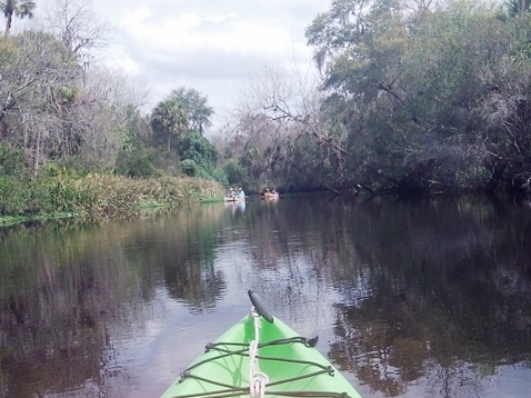
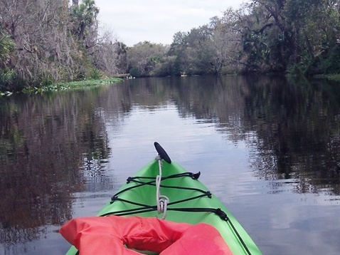
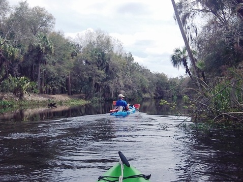
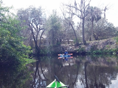
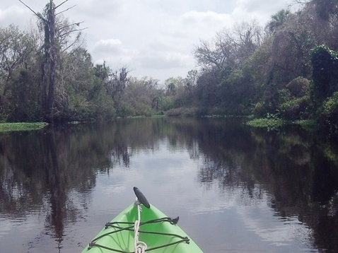
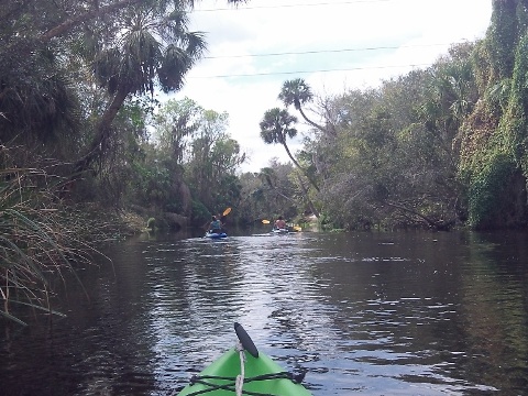
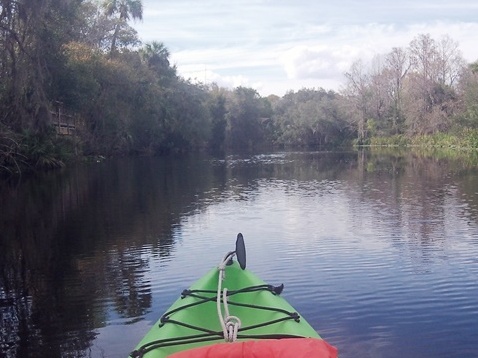
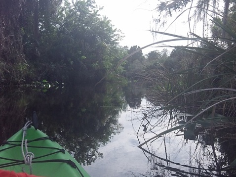
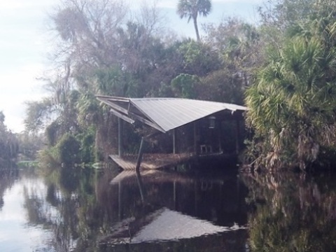
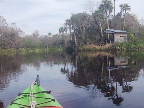
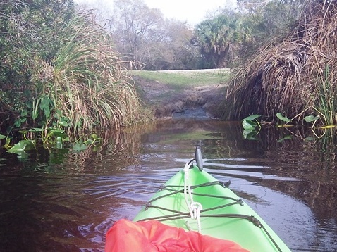
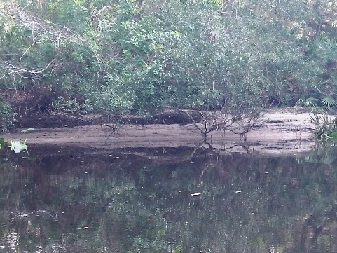
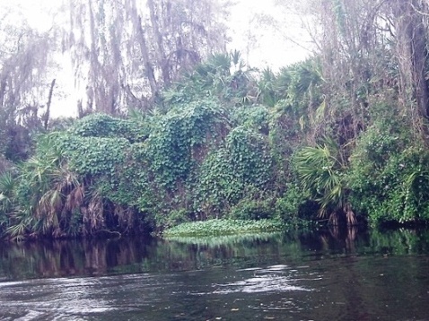
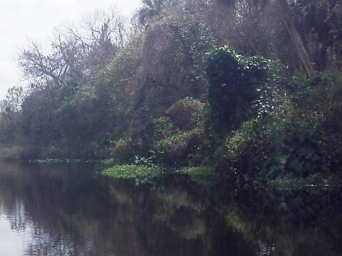
Shell Creek near Punta Gorda is an exceptionally scenic paddle, twisting but mostly wide due to a dam downriver that keeps the water levels high (it narrows further upstream). The creek serves as the water supply for Punta Gorda, so is pristine and undeveloped except for a few homes and cabins along the shore. Once an ancient sea, hunting fossils from the Pleistocene era is a popular pastime. (Detailed map and photos below.)
Distance: From Hathaway Park: 8 miles upstream; 5 miles
downstream to the dam
Location: Charlotte County
Difficulty: Easy
Tidal: No
Launch points: Hathaway Park (35461 Washington Loop Road),
Riverside Park (8320 Riverside Drive) (See map)
Nearby points of interest: Peace River Wildlife Center
(Punta Gorda), Muscle Car City Museum (Punta Gorda), Military Heritage
Museum (Fishermen's Village, Punta Gorda); J.N. "Ding" Darling National
Wildlife Refuge (Sanibel Island), Edison and Ford Winter Homes (Fort Myers)
Rentals/Outfitters/Tours:
N/A
Page Summary:
- Paddling on Shell Creek
- Upstream and Downstream from Hathaway Park
- Launches - Hathaway Park, Riverside Park
- Wildlife and "Dinosaurs" - More Information and Resources
Paddling on Shell Creek... Comments and Photos
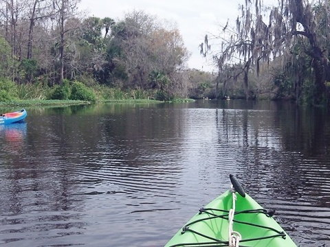
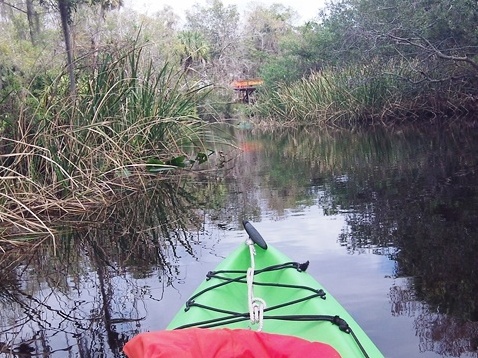
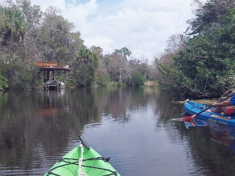
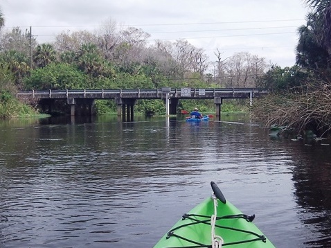
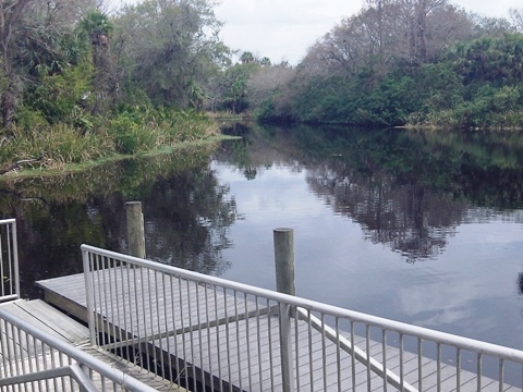
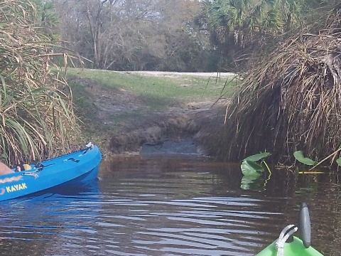
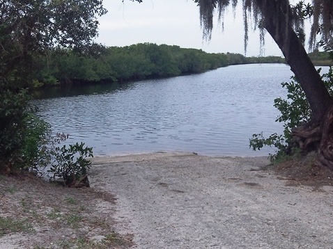
The best paddling is from Hathaway Park upstream about 8 miles or downstream 5 miles to the dam. Upstream, the creek runs for about two miles through wild and natural Shell Creek Preserve. High riverbanks often display fossilized shells from an ancient sea. Launching from the kayak/canoe launch at Hathaway Park, we paddled upstream about 4 miles, and downstream about a half mile. An easy paddle with mild current, alternating between wide and narrow sections - it's more consistently narrow further upstream but we didn't go that far. Few places to pull off to stretch and snack.
Upstream

Launches
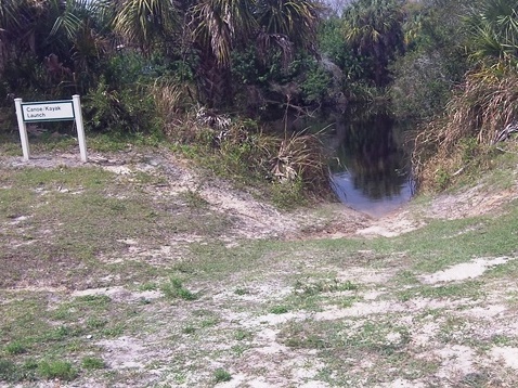
There are two entrances next to each other at Hathaway Park, a boat ramp at one and kayak/canoe launch at the second - use the second which goes to the kayak/canoe launch and also is fee-free. Below the dam close to the Peace River is Riverside Park with a boat ramp and a small beach for kayak launching.
Hathaway Park first entrance
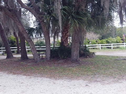
Boat ramp, parking, restroom, picnic, hiking trail; fee
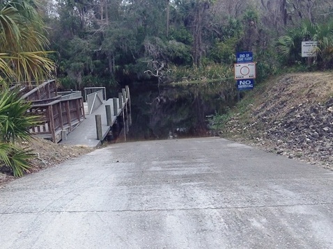
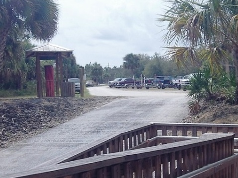
Hathaway Park second entrance
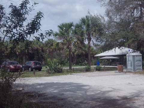
Kayak/canoe launch, parking, port-a-pottie, picnic; no fee
Wildlife and "Dinosaurs"
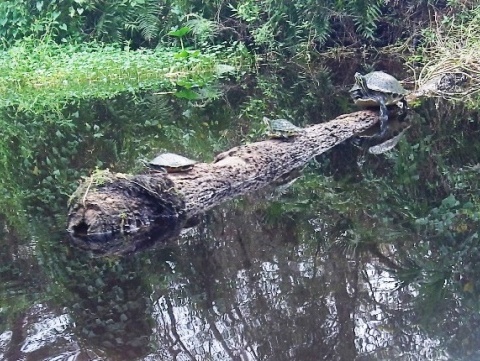
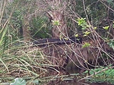
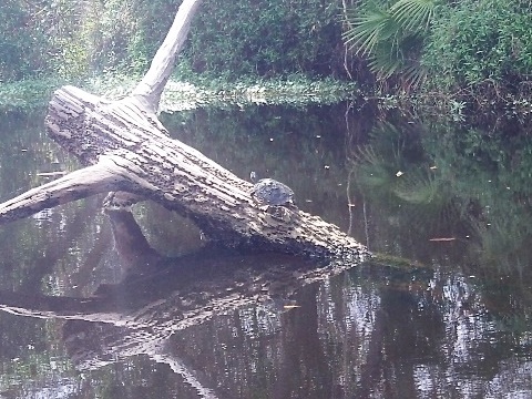
Many turtles, plus alligators and birds. Cypress and oak line the creek; the green kudzu draping the branches create "dinosaur" type sculptures, but unfortunately this is an invasive species.
More Information and Resources
Nearby Paddling:
See FL South Region for more paddling
Nearby Biking:
Punta Gorda
Pathways
Cape Haze
Pioneer Trail
Related Resources:
Charlotte County -
Shell Creek Preserve
Charlotte County -
Hathaway Park
Charlotte
County Blueways Guide
View great paddling by FL Region or Listed A - Z

PaddleFlorida.net... Find Florida's Best Recreational Paddling,
by Kayak, Canoe, and Paddleboard too.
Copyright © PaddleFlorida.net. All Rights Reserved. Paddle Florida®