Paddle Florida®
Over 100 Florida Paddling Destinations
E-Z Maps... Photos... Reports...
You are here > Home >
North Florida >
Ocklawaha River
Latest update: January 2017
Ocklawaha River Kayaking...
South to North in Ocala National Forest
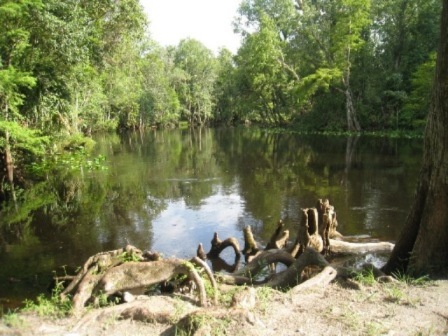
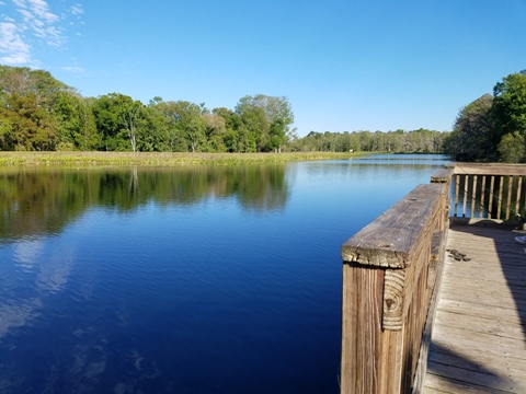
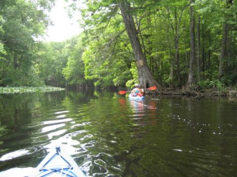
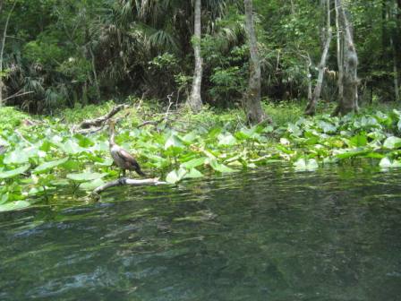
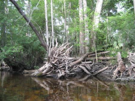
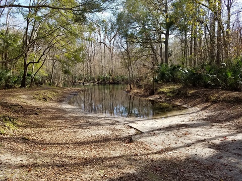
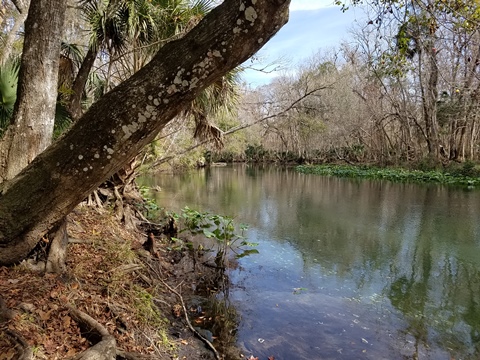
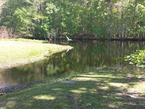
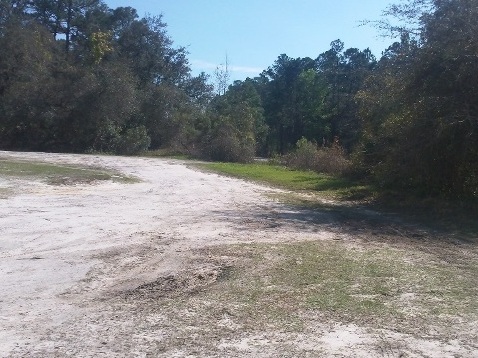
Ocklawaha River flows 74 miles from Lake Griffin in Lake County to the St. Johns River, and is one of the few rivers in the U.S. flowing south to north. The Ocklawaha is one of the most natural and beautiful waterways in Florida, its center section forming the western and northern boundaries of the Ocala National Forest. The Silver River flows into the Ocklawaha near Ray Wayside Park; the influx of water from the first-magnitude Silver Spring changes the flow from slow to fast-flowing river. Wildlife abounds. (Detailed map and photos below.)
Distance: 10 miles from SR 40 to Gore's Landing; 9 miles
Gores's Landing to Lake Ocklawaha; 8 miles Kirkpatrick Dam to Hwy19; 74 in total
Location: Marion and Putnam Counties (Ocala)
Difficulty: Easy to moderate
Tidal: No
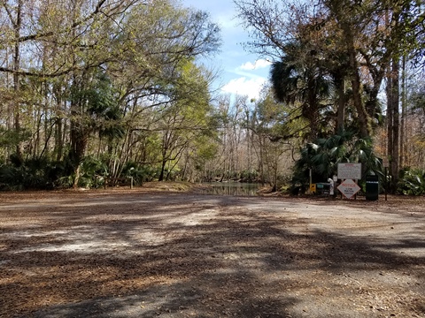
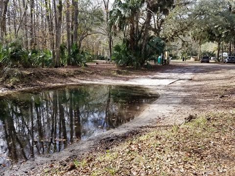
Launch points: Upper: Ray Wayside Park (SR 40 bridge),
Gore's Landing, SR 316 bridge (Lake Ocklawaha). Lower: Kirkpatrick
Dam, SR19 bridge (See map)
Nearby points of interest: Ocala, Silver Springs,
Kirkpatrick Dam/Rodman Reservoir
Rentals/Outfitters/Tours:
Ocklawaha Canoe Outpost and Resort (rentals)
Support and Advocacy:
Page Summary:
- Paddling the Ocklawaha River
- Upper Ocklawaha River
- Moss Bluff to Ray Wayside Park
- Ray Wayside Park to Gore's Landing
- Gore's Landing to the CR 316 bridge
- CR 316 bridge to Kirkpatrick Dam - Lower Ocklawaha River
- Kirkpatrick Dam to SR 19
- SR 19 bridge to the St. Johns River - About Lake Ocklawaha
- More Information and Resources
Paddling the Ocklawaha River... Comments and Photos
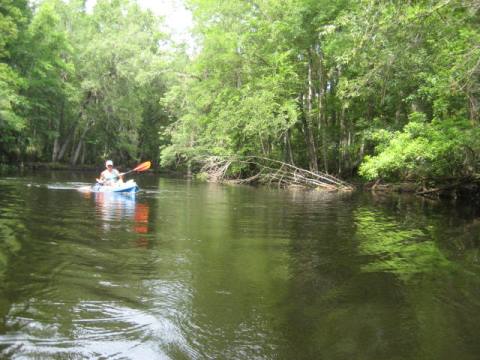
This is a long river. Paddlers have several options; out and back from launch, from point to point using the outfitter's shuttle service, or longer trips with overnight camping (contact outfitter for more information). The most popular paddling areas are Ray Wayside Park to Gore's Landing (about 10 miles), Gore's Landing to the CR 316 bridge (about 9 miles), and the Kirkpatrick Dam to the SR 19 boat ramp (8 miles).
Upper Ocklawaha River
Moss Bluff to Rodman Reservoir (south to north)
Moss Bluff to Ray Wayside Park
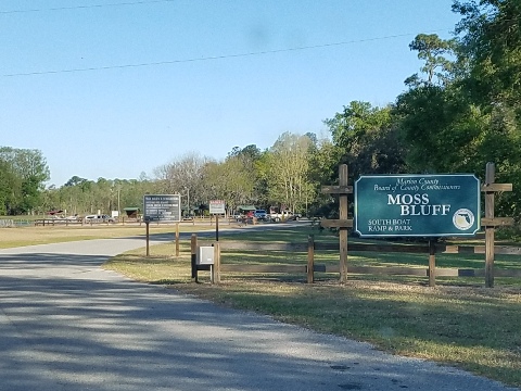
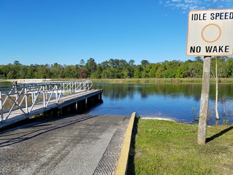
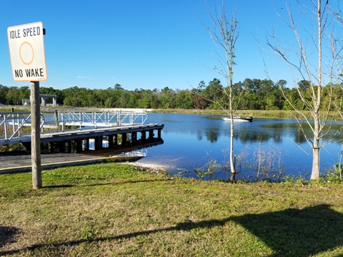
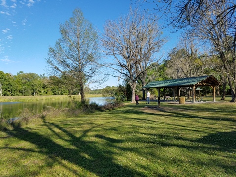
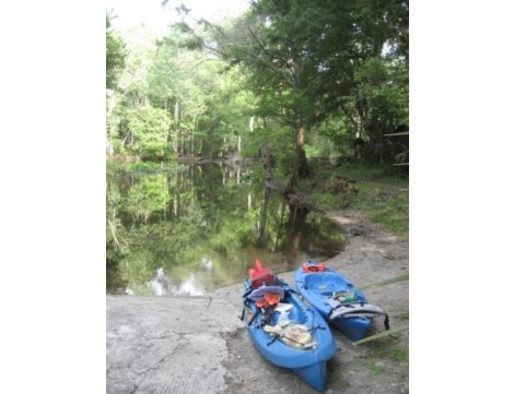
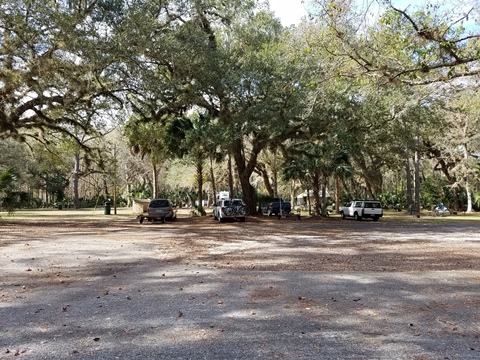
Moss Bluff Lock and Dam to Ray Wayside Park (14 miles) - a portion follows the old canal system. watch for motor boats. Use the South Launch on the upstream side of the dam to proceed toward Ray Wayside Park. At Moss Bluff are boat ramp, picnic tables, restrooms, parking.
Ray Wayside Park to Gore's Landing
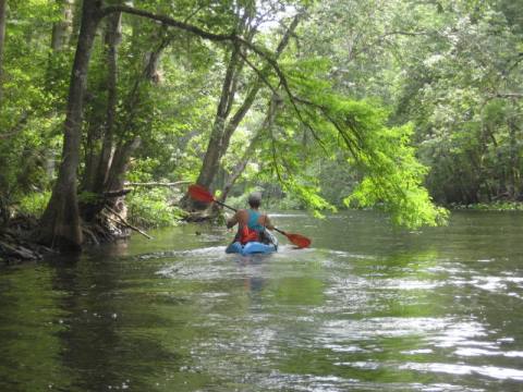
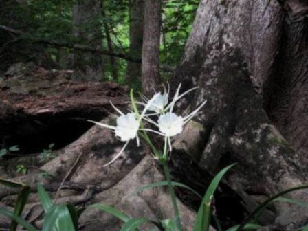
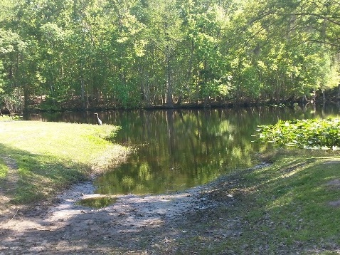
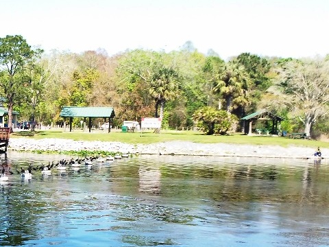
The upper river near Ocala, from Ray Wayside Park at SR 40 to Gore's Landing (about 10 miles). This includes a short distance on the Silver River. Ray Wayside Park facilities include boat ramps, bank fishing, volleyball, a playground, picnic pavilion and restrooms. Watch for assorted wildlife and flowers along the riverbank.
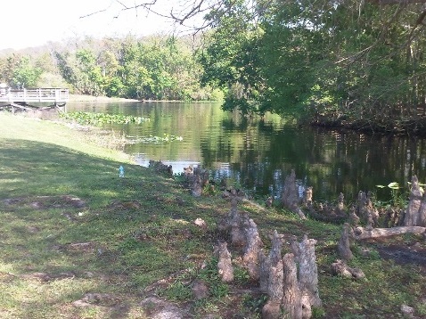
Gore's Landing to the CR 316 bridge
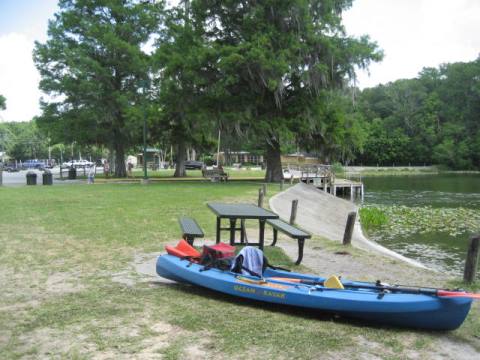
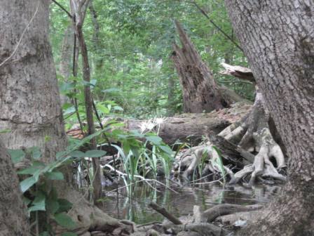
From Gore's Landing to the CR 316 bridge, or just beyond to the outfitter's landing (about 9 miles). Along the way, there are several side creeks to explore. At Gore's Landing are a boat ramp, primitive camping, restroom and picnic tables.
CR 316 bridge to Kirkpatrick Dam
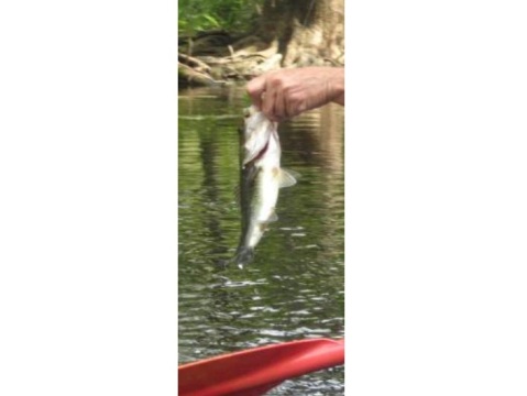
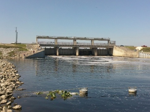
CR 316 bridge to Kirkpatrick Dam - this takes you through Lake Ocklawaha and Rodman Reservoir - wide, popular for fishing, many powerboats.
Lower Ocklawaha River
Rodman Recreation Area to St. Johns River
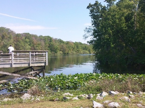
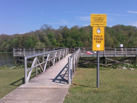
Kirkpatrick Dam to SR 19
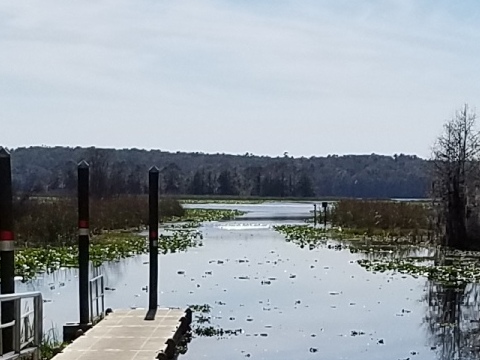
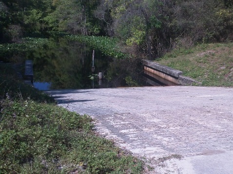
The lower river (downstream from Rodman Reservoir) from the Rodman Recreation Area at Kirkpatrick Dam to the SR 19 boat ramp (8 miles). The Rodman Recreation Area has parking, boat ramp, kayak launch, restrooms, picnic area, fishing pier.
SR 19 bridge to the St. Johns River
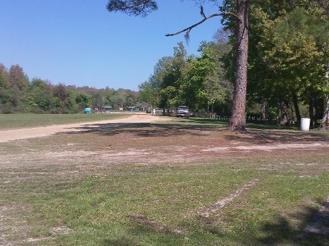
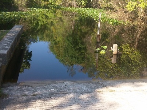
From the Johnson Field Boat Ramp at the SR 19 bridge to the St. Johns River (5 miles) - winding with many side streams, a good GPS and map are recommended. On the St. Johns, it's then about a mile north to Welaka. At the bridge is parking and the boat ramp, no other facilities.
About Lake Ocklawaha
Lake Ocklawaha was formed by Rodman Dam (now renamed the Kirkpatrick Dam). At one time the Ocklawaha was slated to be part of the Cross Florida Barge Canal and was channelized and developed, the dam was part of that project. Construction was halted in 1971 due to the efforts of environmentalist Marjorie Harris Carr and the Florida Defenders of the Environment (FDE). Restoration efforts have worked to restore the original river channel; proposals to dismantle the dam are debated by those who enjoy the fiishing and recreational opportunities on Rodman Reservoir and Lake Ocklawaha.
More Information and Resources
Nearby Paddling:
Silver River
Juniper Springs Run
See FL North Region for more paddling
Related Resources:
Florida State Parks - Rodman Recreation Area
USDA Forest Service -
Non-motorized Boating in Ocala National Forest
Ocklawaha Canoe Outpost and Resort -
Ocklawaha River Trips
View great paddling by FL Region or Listed A - Z

PaddleFlorida.net... Find Florida's Best Recreational Paddling,
by Kayak, Canoe, and Paddleboard too.
Copyright © PaddleFlorida.net. All Rights Reserved. Paddle Florida®