Paddle Florida®
Over 100 Florida Paddling Destinations
E-Z Maps... Photos... Reports...
You are here > Home >
Florida Panhandle >
Ochlockonee River
Trip report: April 2018
Ochlockonee River, Florida...
Paddling at Ochlockonee River State Park
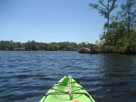
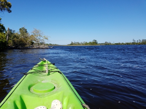
The Ochlockonee River originates in south Georgia and flows 206 miles to the Gulf of Mexico at Apalachee Bay. Two Florida Designated Paddling Trails total 89 miles, separated by Lake Talquin and Jackson Bluff Dam. We visited the southern terminus of the Lower Trail at Ochlockonee River State Park. Here the river is wide and brackish, but we focused on four side creeks, all entering the river near our launch point, all with shelter from the wind, and together providing miles of unique, sometimes fast-changing salt to freshwater paddling environments. (Detailed map and photos below)
Distance: Upper Ochlockonee Paddling Trail - 27 miles;
Lower Ochlockonee Paddling Trail - 62 miles. 206 miles total
Location: Wakulla, Franklin, Liberty, Leon Counties
Difficulty: Easy to difficult
Tidal: Yes, approaching the Gulf. River levels also
can be affected by water releases from the Jackson Bluff Dam (Lake Talquin).
Launch points: Numerous, see map. (See map)
Nearby Points of interest: Tallahassee
Rentals/Outfitters/Tours:
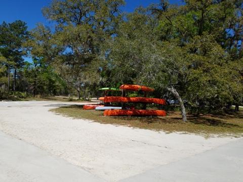
Ochlockonee River State Park (rentals)
Support and Advocacy:
Page Summary:
- Paddling at Ochlockonee River State Park
- State Park Launch - Tide Creek and side creeks
- Little Tide Creek
- Upper Tide Creek - Ochlockonee River and side creeks
- Cow Creek
- Bear Creek
- Return to Launch - Ochlockonee River State Park
- About the Paddling Trails
- More Information and Resources
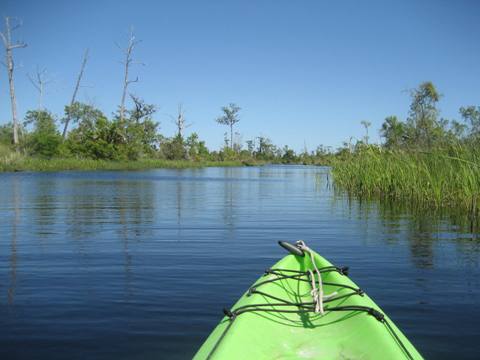
Paddling at Ochlockonee River State Park... Comments and Photos
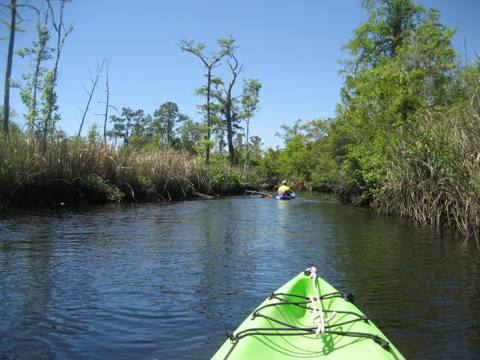
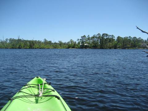
Here, wind and tide are factors. Side creeks near the launch offer shelter and above all, an amazing variety of scenery as you transition from brackish water to all freshwater environments. Plant life and bird life change, wildflowers begin to dot the banks, a few turtles and alligators appear, some shade in upper portion of 3 of 4 creeks we explored. The State Park has two official 7.5 mile Paddling Loops – Dead River/ Sopchoppy River Loop and Bear Creek Loop - which we didn't paddle, except for a short portion of Bear Creek. For the best shelter and greatest variety of scenery, we recommend the two side creeks off Tide Creek. It was fun paddling under the bridge over Little Tide Creek (wasn't sure it was passable; thank you State Park staff and volunteers). Upper Tide Creek is a hidden gem. Quiet and remote, we rate this area an A+ springtime paddle.
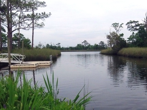
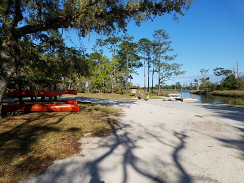
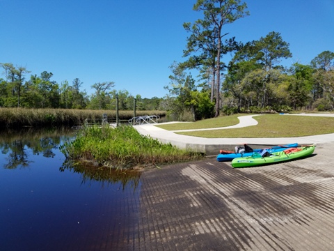
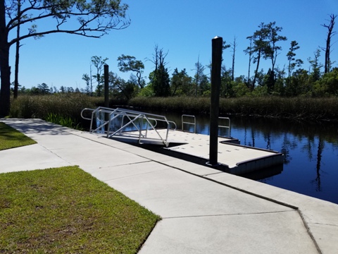
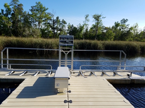
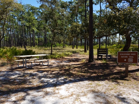
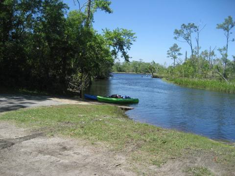
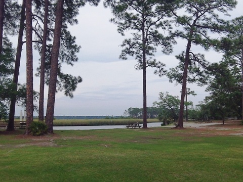
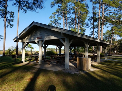
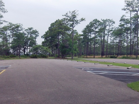
State Park Launch Area
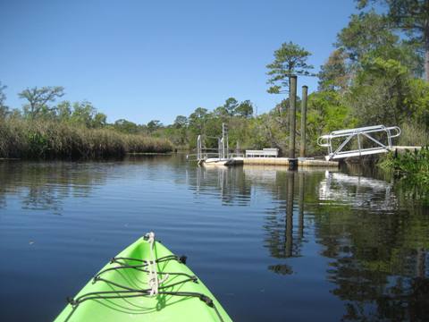
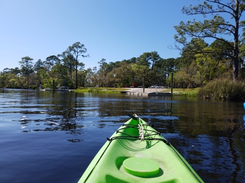
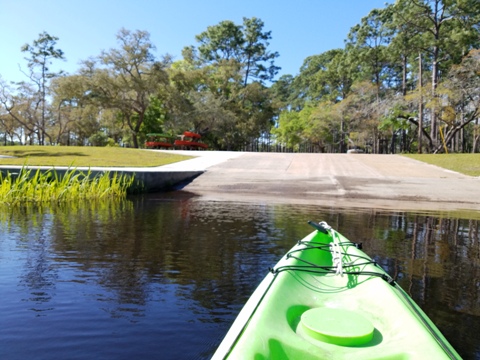
The launch area has parking, boat ramp, restroom, picnic area, floating dock, and a handicapped-accessible kayak launch platform. We launched from the side of the wide, paved boat ramp.
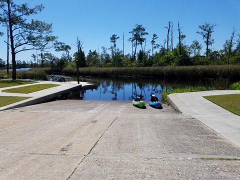
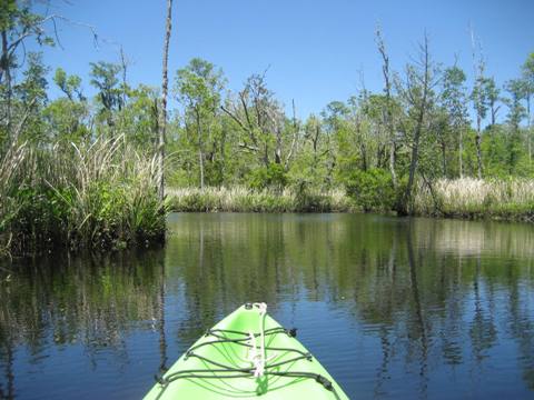
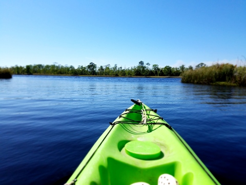
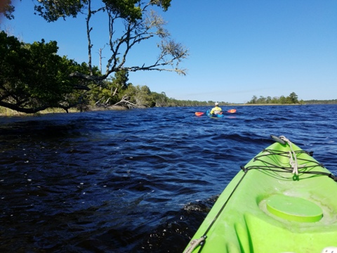
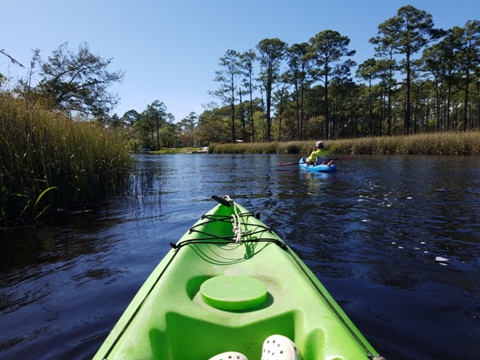
From the launch, we turned right and paddled the length of Tide Creek (about 1 mile parallel to the river). Along the way, we paddled up and back on both Little Tide Creek and Upper Tide Creek. We then crossed the Ochlockonee River and explored the lower portion of two other creeks, Cow Creek and Bear Creek. Then with the wind at our backs, we paddled diagonally across the river, nearing the tip of Chesley Island to the mouth of Tide Creek and back to the launch.
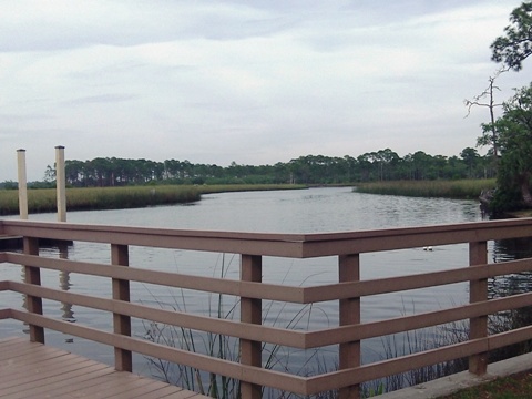
Tide Creek and side creeks
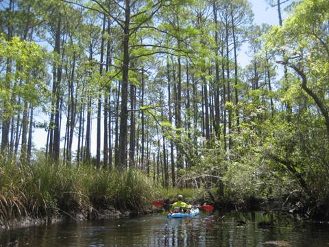
Tide Creek - Little Tide Creek
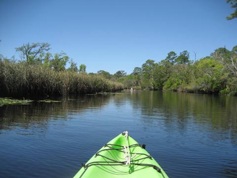
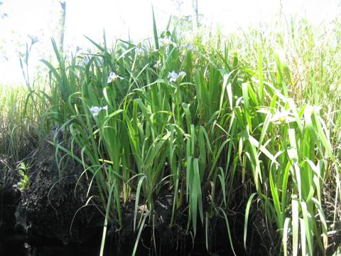
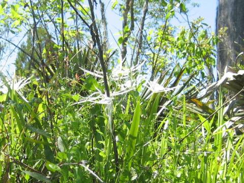
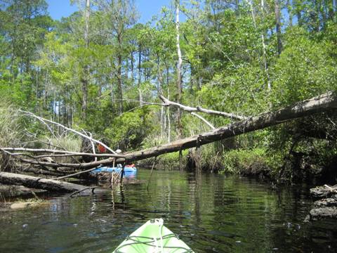
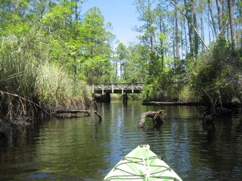
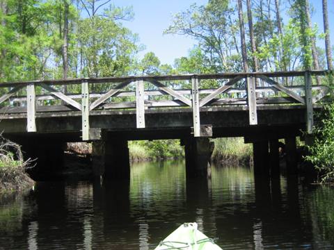
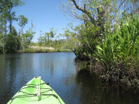
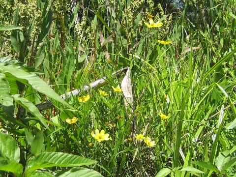
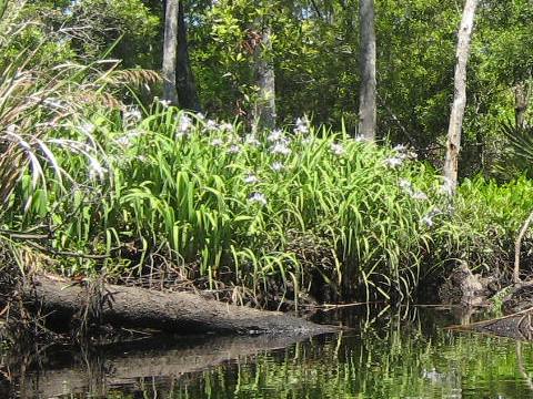
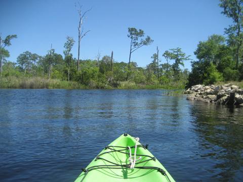
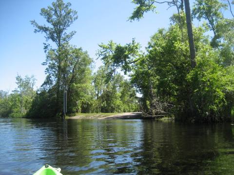
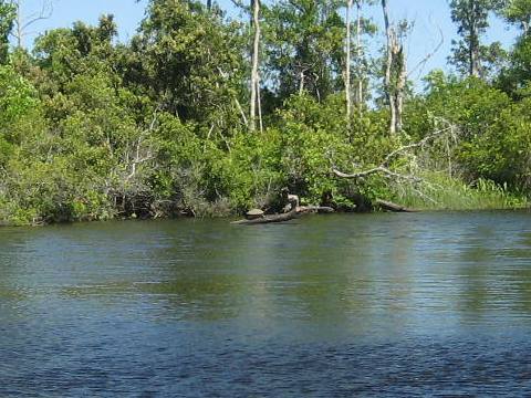
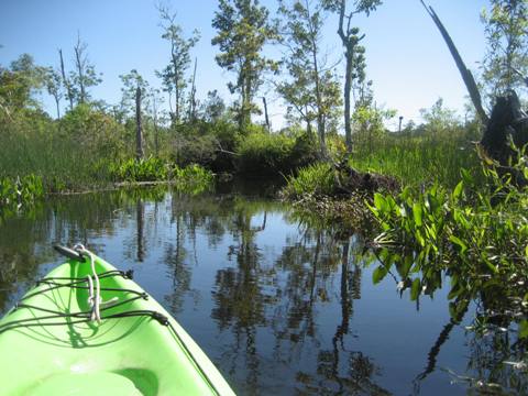
Launching from the boat ramp, we paddled on Tide Creek about 4/10 mile to Little Tide Creek. We then paddled up Little Tide Creek to the wooden bridge at the main park road (about a mile). Twisting and turning, the creek narrowed as it approached the bridge, with more obstacles in the water. Downstream, saltwater intrusion was seen by the bare trees and plant life along the shoreline. Going upstream, the water became fresher and the vegetation changing, with more shade. The many flowers along the bank were notable. We paddled at low tide, if higher we would not have been able to get under some tree limbs and wouldn't have reached the bridge.
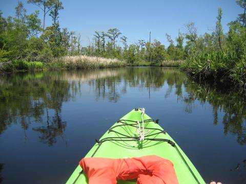
Tide Creek - Upper Tide Creek
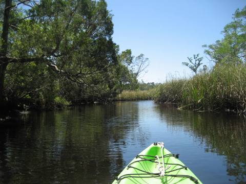
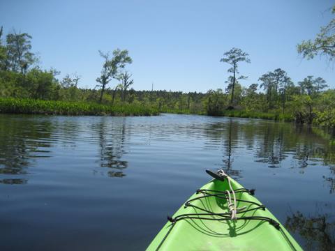
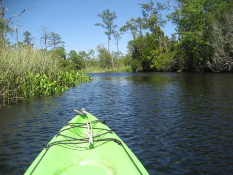
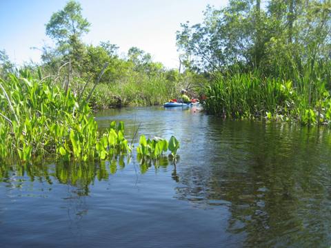
From Little Tide Creek we continued on Tide Creek, about 6/10 mile. The creek opens up onto the river, but first we continued on Upper Tide Creek - which turned out to be our favorite section. With much variety, lined with flowers, some shade and wildlife, this was our kind of paddle. If we're back in the area, we would paddle further here.
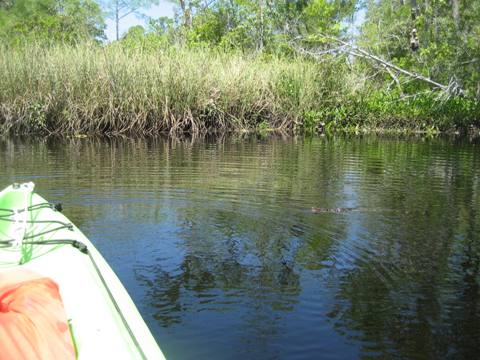
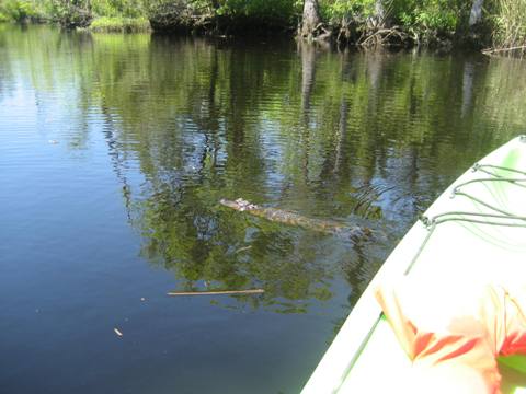
We didn't see a lot of wildlife, some turtles, birds, and mostly splashes from gators jumping into the water as we approached. One little gator jumped into the water and we thought he'd go hide, but instead he swam up to the kayak and circled - first time we ever saw that behavior, we wondered if people had fed it. Then another one did the same thing!
Ochlockonee River and side creeks
Ochlockonee River - Cow Creek
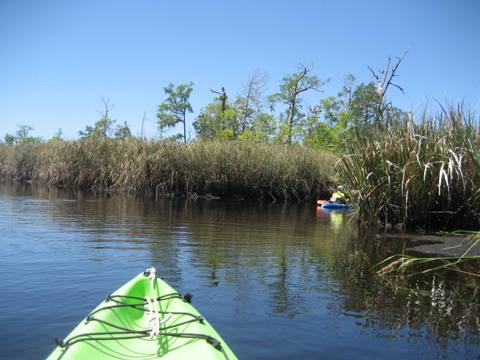
From Tide Creek, we paddled across the river about 2/10 mile to Cow Creek. Right after entering the creek a landing spot was a welcome sight, the only place to stop and stretch on the whole trip. We paddled a short way on Cow Creek before returning to the river to continue our trip.
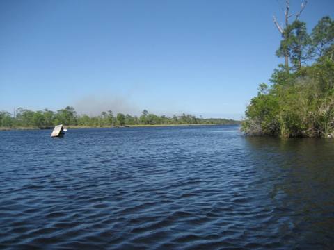
Ochlockonee River - Bear Creek
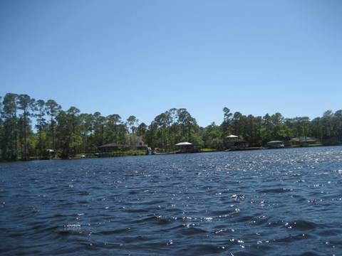
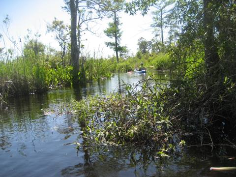
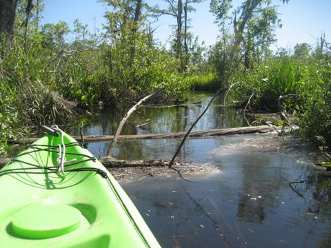
Back on the river, it was another 3/10 mile to Bear Creek. Smoke in the sky was from a controlled burn at the park. The Bear Creek Loop extends 7.5 miles but it was wide with no shade and we only went a short distance, so did not get to the sand bluff which is said to provide great views of Ochlockonee Bay. We had noticed some side creeks and decided to explore one of them. We were glad we did, narrow and scenic with some obstacles to maneuver, we paddled until stopped by logs.
Return to Launch
Leaving Bear Creek, we paddled about 9/10 mile on the Ochlockonee River, past Chesley Island and back to Tide Creek and launch. The wind had come up and it was a rough paddle with some whitecaps. Chesley Island is in the middle of the river, creating two channels; the Dead River meets the Ochlockonee at the far end.
Ochlockonee River State Park
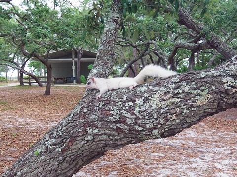
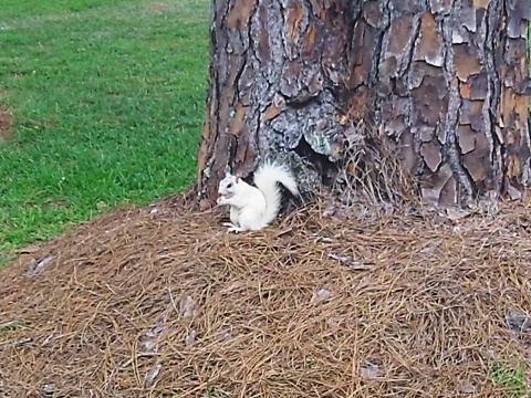
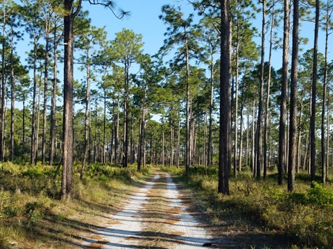
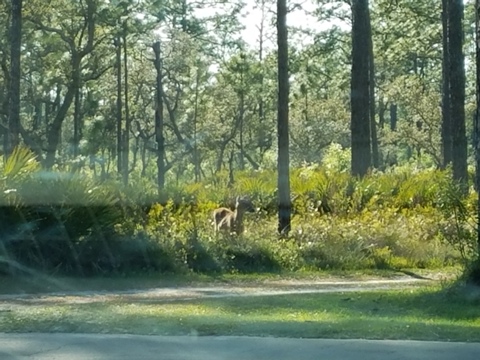
Ochlockonee River State Park is at the convergence of the Ochlockonee River and Dead River. At the point where the rivers converge are a picnic and swimming area, playground. There also are hiking trails, boat ramp, campsites with restrooms and showers. Bike rentals are available and biking allowed on the park drive, the scenic drive, and multi-use trails. Wildlife include turtles, alligators and many birds including the endangered red-cockaded woodpecker. Fishing is popular including bass, sea trout, redfish and speckled perch. The white squirrels are unique.


About the Paddling Trails
- The 27-mile Upper Ochlockonee Paddling Trail begins near the Georgia state line. Narrow and twisting, it runs through a totally undeveloped area ending at Lake Talquin. There can be many obstacles in the river, and the easier paddle is the 12 miles from the Old Bainbridge Road Bridge access.
- The 62-mile Lower Ochlockonee Paddling Trail is more developed, with numerous campsites and fishing camps. Most of this scenic river winds through the Apalachicola National Forest wilderness and other public lands, with high pine bluffs and hardwood forest. Sandbars and beaches provide stopping points. Camping available. Near Ochlockonee River State Park, the end of the trail, the river widens and motorboats are more common. Releases from the Jackson Bluff Dam vary water levels, and deadfall may be present during low water and after storms.
More Information and Resources
Nearby Paddling:
See FL Panhandle Region for more paddling
Nearby Biking:
Ochlockonee
Bay Trail
Tallahassee-St. Mark's
Historic Railroad State Trail
Related Resources:
Florida Greenways and Trails-Upper Ochlockonee River Paddling Trail (.pdf)
Florida Greenways and Trails-Lower Ochlockonee River Paddling Trail (.pdf)
Florida State Parks - Ochlockonee River State Park
View great paddling by FL Region or Listed A - Z

PaddleFlorida.net... Find Florida's Best Recreational Paddling,
by Kayak, Canoe, and Paddleboard too.
Copyright © PaddleFlorida.net. All Rights Reserved. Paddle Florida®