Paddle Florida®
Over 100 Florida Paddling Destinations
E-Z Maps... Photos... Reports...
You are here > Home >
East-Central Florida >
Shingle Creek Paddling Trail
Latest update: May 2022
Shingle Creek Paddling Trail...
Paddling Gem Near Disney World
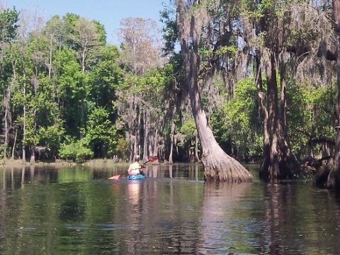
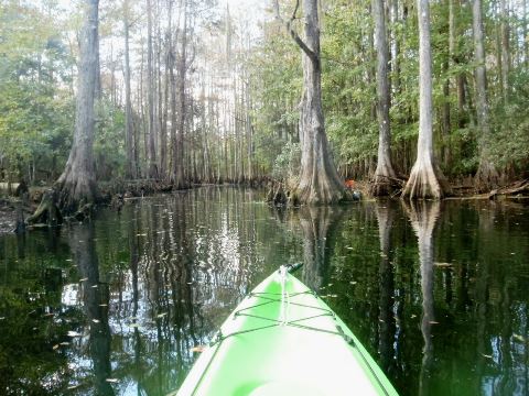
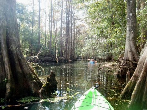
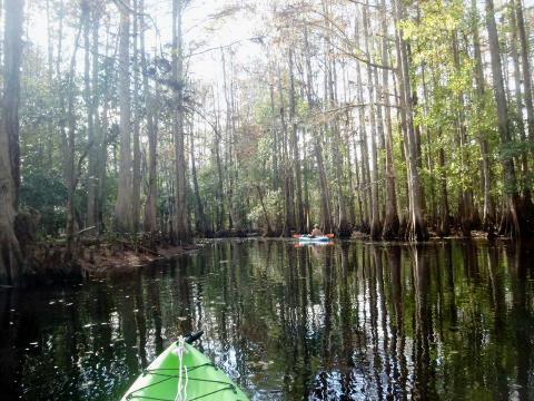
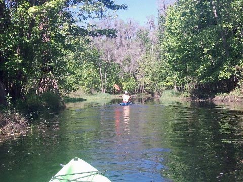
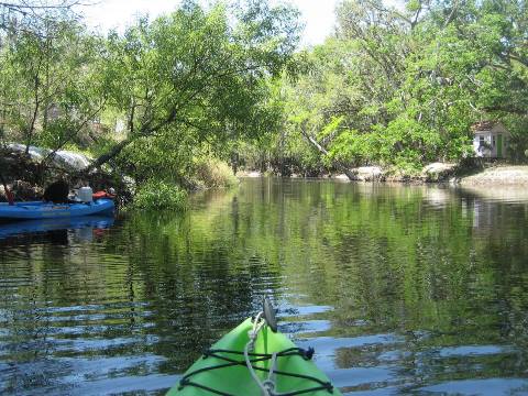
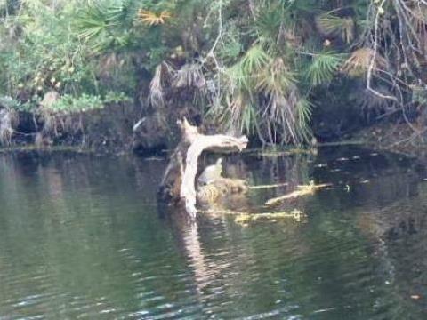
The launch at Steffee Landing (Shingle Creek Regional Park) along the busy Disney tourist corridor on US192 in Kissimmee (mile marker 15) belies the tranquil world of Shingle Creek and Shingle Creek Regional Park. The park covers 1,000 acres from the Orange/Osceola County line at the north to Lake Toho at the south, and the paddling trail runs through the park in two sections: from Steffee Landing to Babb Landing, and from Marsh Landing to Lake Toho. It's one of the prettiest we've seen - with alligators, turtles, myriad water birds and a beautiful cypress forest. This is a great option for taking a break from the theme parks and visiting the "real" Florida. (Detailed map and photos below.)
Distance: 7 mile paddling trail; 20 miles total
Location: Osceola County (Kissimmee)
Difficulty: Easy to Difficult
Tidal: No
Launch points: Steffee Landing (W. Vine St./US192); Marsh Landing
(Marsh Rd.); Babb Landing (Babb Road)
(See map)
Nearby points of interest: Walt Disney World, Sea World,
Universal Studios, Warbird Museum, Silver Spurs Rodeo, Gatorland
Rentals/Outfitters/Tours:
Whenever Watersports (self-service kayak rentals)
Page Summary:
- Paddling on Shingle Creek
- Paddling from Steffee Landing
- Steffee Landing at Shingle Creek Regional Park
- South from Steffee Landing
- North from Steffee Landing
- Babb Landing at Shingle Creek Regional Park - Paddling from Marsh Landing
- Marsh Landing at Shingle Creek Regional Park
- North from Marsh Landing
- South from Marsh Landing - Wildlife Along Shingle Creek
- About Shingle Creek
- More Information and Resources
Paddling on Shingle Creek... Comments and Photos
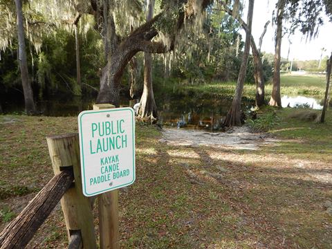
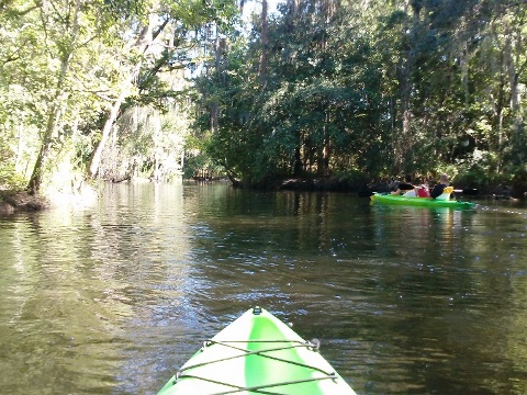
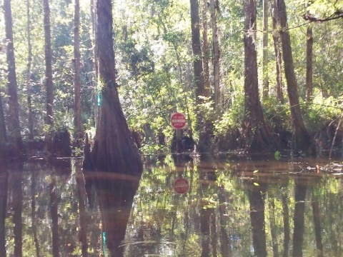
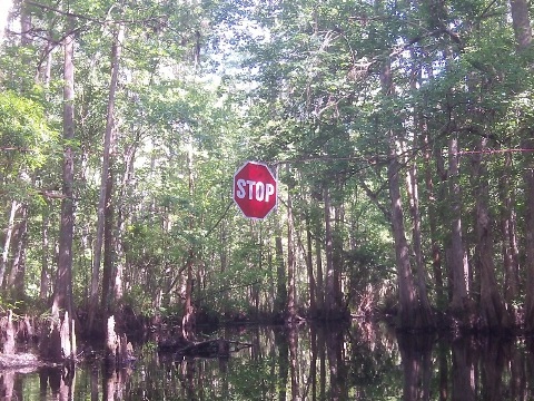
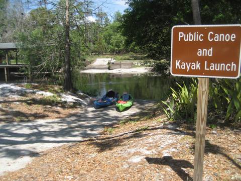
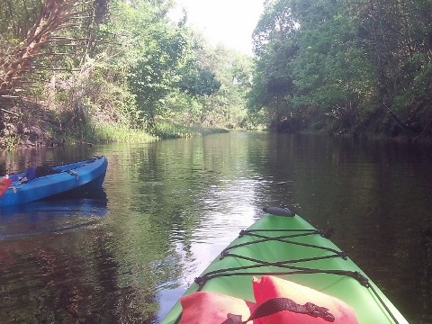
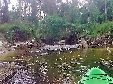
The paddling trail winds through the park and includes three access points on Shingle Creek: (1) The main launch is Steffee Landing at US 192, it's the most accessible and popular for the north and middle sections; (2) Babb Landing at the north off Babb Rd., is near the end of the Designated Paddling Trail and a good stopping point when paddling from Steffee Landing; (3) Marsh Landing off Hoagland Blvd. is along the south section to Lake Toho. For most people the creek is best paddled as an out and back between Steffee Landing and Babb Landing. Between Steffee Landing and Marsh Landing is a heavily wooded (mostly stumps and logs) rapids. This section is twisting and turning, often blocked and impassable. Paddling is not recommended with "Do Not Enter" and "Stop" signs posted - don't be one of those for whom rescue parties needed to be sent out!
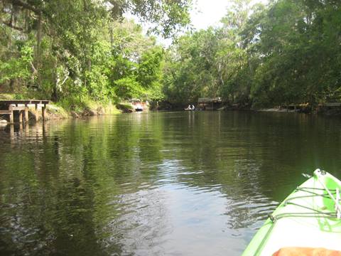
Paddling from Steffee Landing
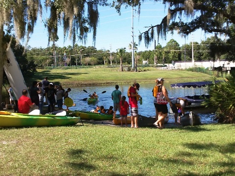
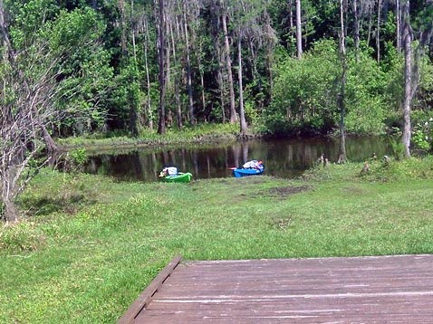
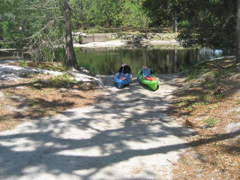
Steffee Landing at Shingle Creek Regional Park
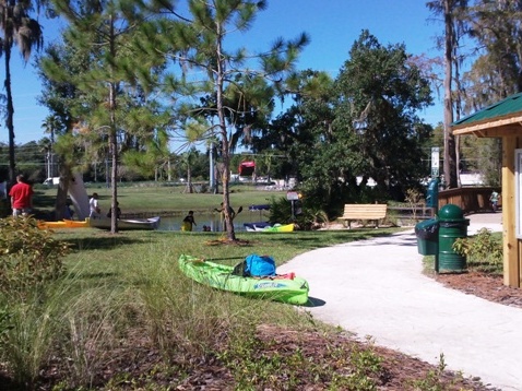
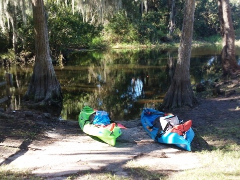
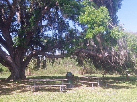
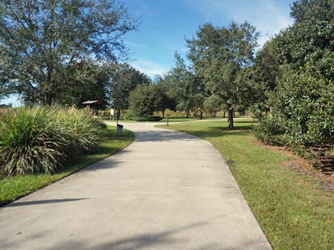
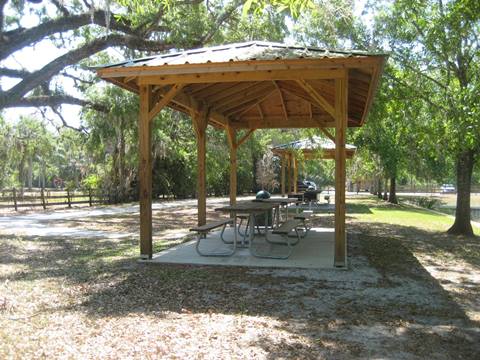
Steffee Landing at Shingle Creek Regional Park is the most popular launch point onto Shingle Creek. Paddle south through a beautiful cypress swamp, or north to Babb Landing. Here are a canoe and kayak launch (no motor boats are allowed!), fishing dock, hiking trails, picnicking, play area, and restrooms. Kayak rentals available. Some old homes from the historic Shingle Creek community are within the park with others slated for restoration. The Shingle Creek Regional Trail (biking) also runs through the park (link below).
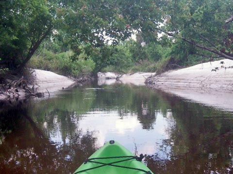
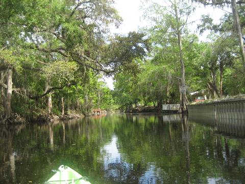
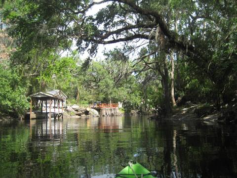
South from Steffee Landing
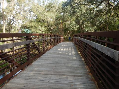
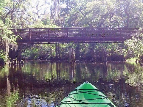
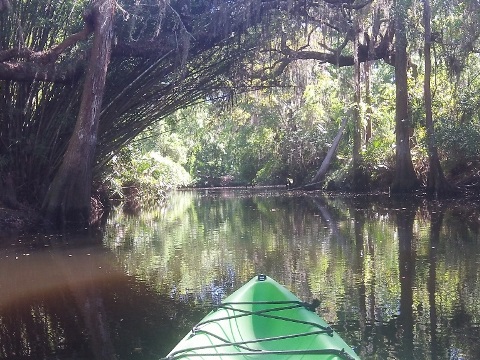
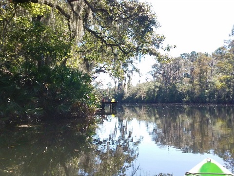
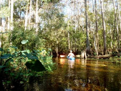
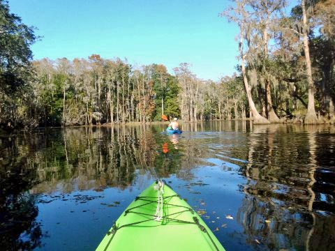
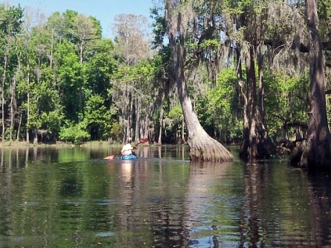
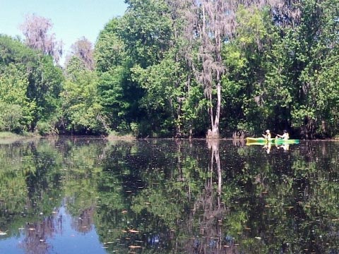
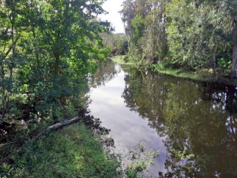
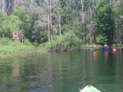
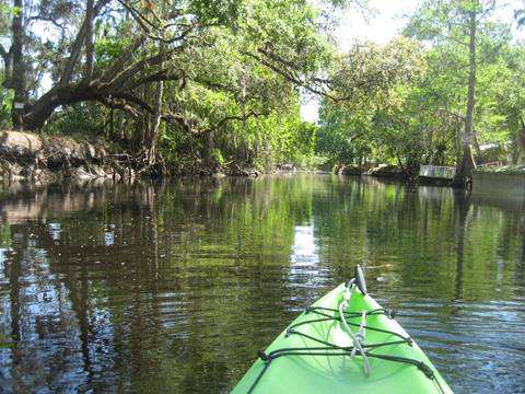
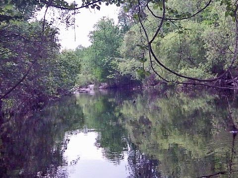
Leaving the launch going south, the creek goes under a pedestrian bridge linking to the historical Steffee Homestead (parking, restroom, picnic). Initially wide, the creek narrows as it enters the beautiful cypress swamp - a significant feature of the creek. This area is more remote with narrow channels and a few wider spots, lined by palmetto palm and cypress. The warning signs mark the beginning of the section leading to the rapids. Again, we do not recommend paddling past this point. (A route through the maze is marked in orange to show the way for those who choose to ignore the signs, it's easy to get lost - dangerous and often impassable at the rapids, even the most experienced paddlers avoid this.)
The serenity of this section is only occasionally interrupted by air traffic at nearby Kissimmee Gateway Airport, and close to that, a gun range (law enforcement only) sometimes in use.
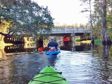
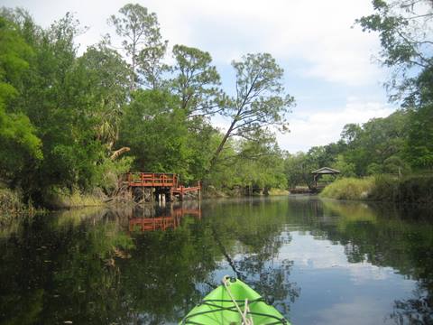
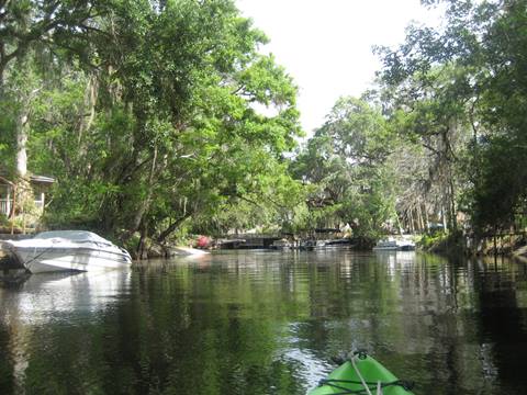
North from Steffee Landing
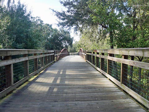
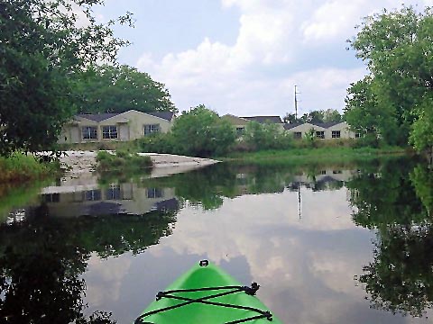
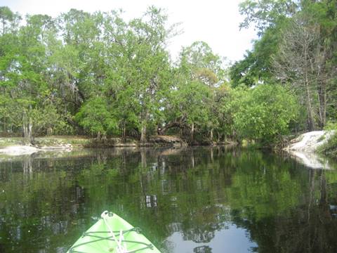
This is an easy 2-mile round trip. Heading north, the creek is wider and deeper with less current, a popular area for fishing. From the landing, the creek runs under US 192, then the paddling trail ends about a mile upstream just past Babb Landing. This is a nicely wooded section, but at points we could see the condos and apartments through the trees. You may also see cyclists in the distance, as a section of the multi-use Shingle Creek Regional Trail runs near the creek. A bridge crosses the creek, connecting the multi-use trail to Pioneer Village and Babb Landing.
Babb Landing at Shingle Creek Regional Park
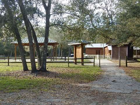
Babb Landing is near the northern end of the paddling trail. Access to the landing is by water, foot or bike - used as a pull-off from the creek when paddling from Steffee Landing. A boardwalk leads to a picnic area along the multi-use trail.
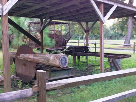
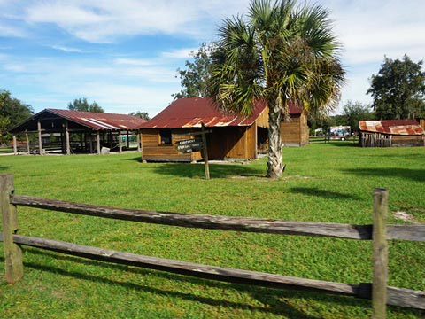
This is the site of the old Babb family residence and orange groves. Shingle Creek Regional Park here includes parking, restroom, information center, picnic tables, hiking paths, and biking trail. The Pioneer Village on the site uses authentic structures, which once stood in different areas of Osceola County.
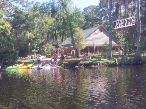
Paddling from Marsh Landing
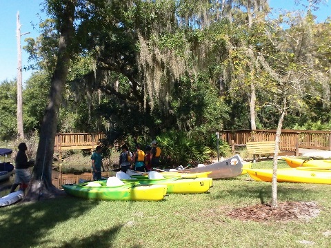
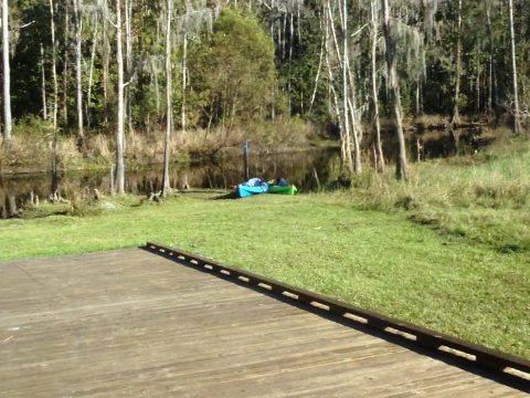
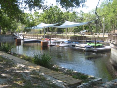
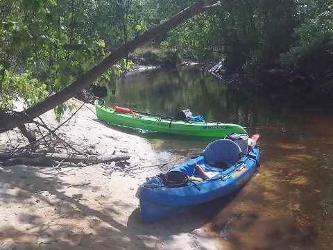
Marsh Landing at Shingle Creek Regional Park
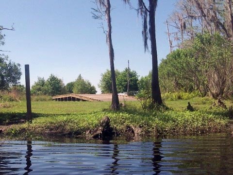
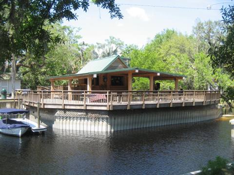
Marsh Landing has a public kayak/canoe launch, plus parking, restrooms, picnicking, and a deck available for group rentals. From here, you can paddle upstream to the dunes and rapids area, or downstream to Lake Toho.
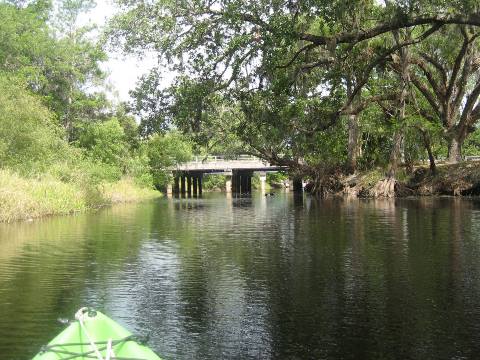
North from Marsh Landing
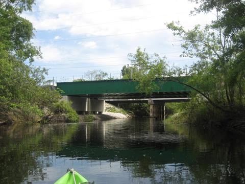
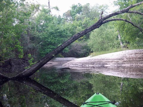
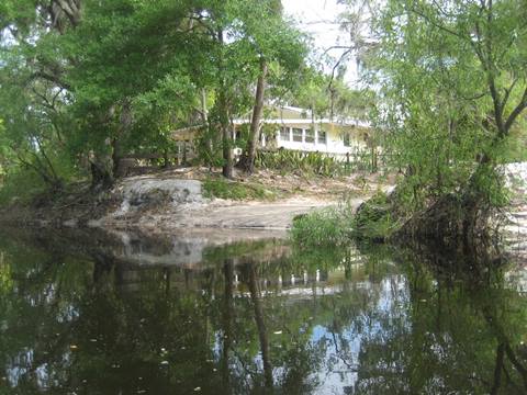
Paddling north, the creek passes some residential areas along the banks, and under Old Tampa Highway. A wide drainage canal entering from the west just north of the bridge can also be paddled. Past here the creek runs within a secluded section of Shingle Creek Regional Park. This is scenic with ancient dunes and high banks, offering many spots to stop and snack. At the rapids, the creek becomes impassable with the swift current making it doubly so.
South from Marsh Landing
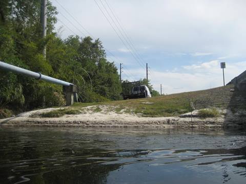
South from Marsh Landing the creek skirts some residential areas, and goes under bridges at S. Hoagland Blvd. and US 17/92 as it approaches Lake Toho. We paddled a short distance past S. Hoagland before returning to launch.
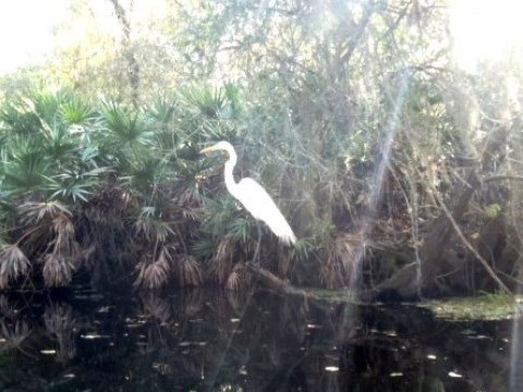
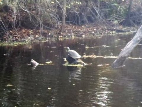
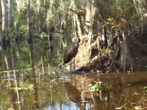
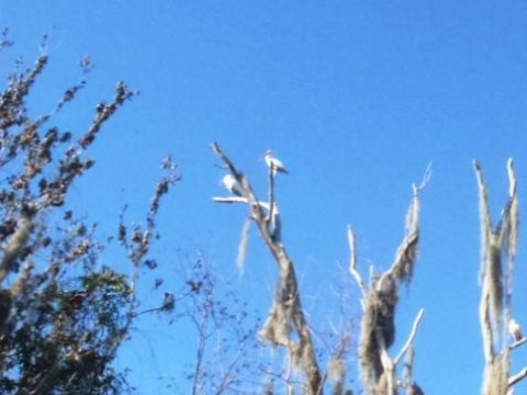
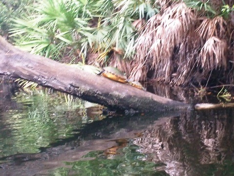
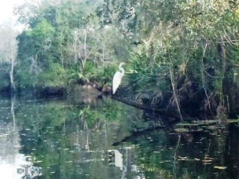
Wildlife Along Shingle Creek
Wildlife
Wildlife include fish, alligators, bald eagles, wild turkey, great blue heron, turtles, white-tailed deer and a few river otters.
About Shingle Creek
Shingle Creek was named in the late 19th century after the cypress trees that lined the bank, which were used to make wood shingles. Beginning in south Orange County, the creek is the major tributary of Lake Tohopekaliga (Lake Toho), the northernmost headwaters of The Everglades. It flows about 20 miles past the International Drive tourist area south to Kissimmee, and then to Lake Toho where its waters continue their 300+ mile journey to The Everglades and Florida Bay. The stream and surrounding area are protected wetlands due to their importance to Everglades restoration efforts.
More Information and Resources
Nearby Paddling:
See FL East-Central Region for more paddling
Nearby Biking:
Shingle Creek Regional Trail
(Osceola Cty.)
More Bicycling in Osceola County
Related Resources:
Osceola County Parks and Recreation - Shingle Creek Regional Park
View great paddling by FL Region or Listed A - Z
PaddleFlorida.net... Find Florida's Best Recreational Paddling,
by Kayak, Canoe, and Paddleboard too.
Copyright © PaddleFlorida.net. All Rights Reserved. Paddle Florida®