Paddle Florida®
Over 100 Florida Paddling Destinations
E-Z Maps... Photos... Reports...
You are here > Home >
North Florida >
Paddle Bulow Creek
Trip report: May 2016
Bulow Creek...
Kayaking in Northeast Florida
Bulow Creek flows about 11 miles in Flagler and Volusia Counties. A 6.5 mile (one-way) Designated Paddling Trail runs from Bulow Plantation Ruins Historic State Park downstream to the Intracoastal Waterway at North Peninsula State Park. We liked paddling upstream from the official trail (above the ruins), it's possible to go about 3.5 miles before the creek narrows and becomes blocked. (Detailed map and photos below.)
Distance: 11 miles; 6.5 mile paddling trail
Location: Flagler County (Flagler Beach)
Difficulty: Easy to moderate
Tidal: Yes
Launch points: Bulow Plantation Ruins Historic State Park,
Walter Boardman Bridge, Smith Creek Landing. (See map)
Nearby points of interest: Flagler Beach, Bulow Creek State Park, Tomoka State Park
Rentals/Outfitters/Tours:
Bulow Plantation Ruins Historic State Park (rentals, check at the park office)
Tropical Kayaks (rentals, sales, tours)
Support and Advocacy:
Page Summary:
- Paddling on Bulow Creek
- Launch at Bulow Plantation
- Bulow Plantation Ruins - Upstream - Bulow Plantation Ruins Historic State Park
- More Information and Resources
Paddling on Bulow Creek... Comments and Photos
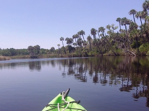
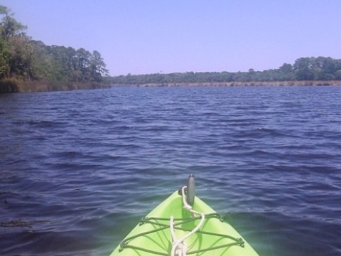
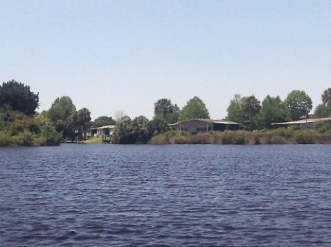
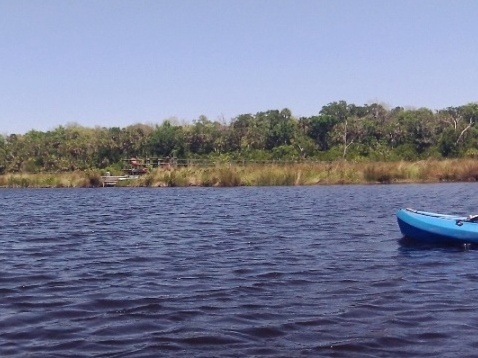
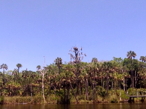
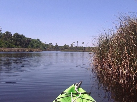
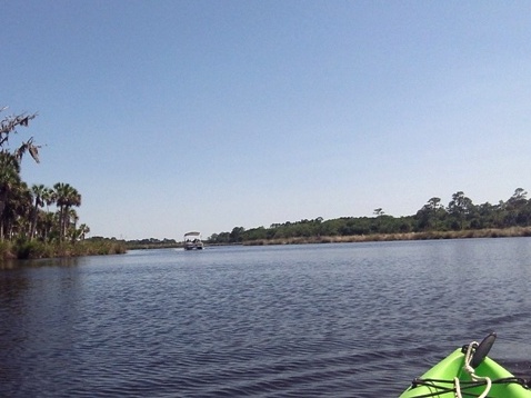
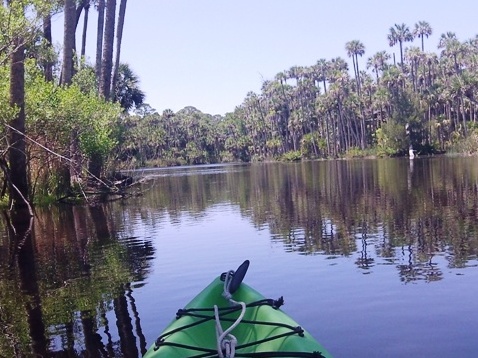
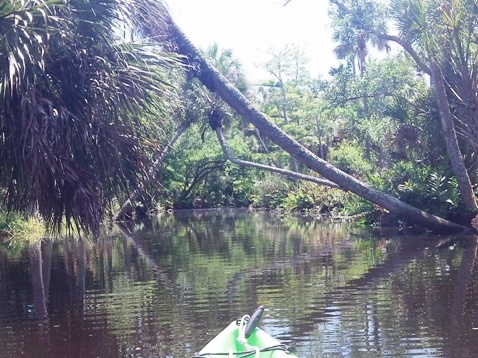
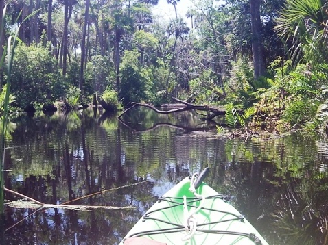
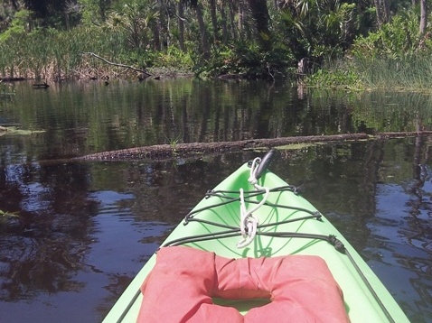
The creek is a mostly easy paddle with a few more technical sections upstream. The paddling trail runs downstream from Bulow Plantation Ruins to the Halifax River (Intracoastal Waterway). Here the creek is wide and lined with coastal marsh grass, with no shade. Approaching the Intracoastal, the water becomes more brackish. Upstream from Bulow Plantation Ruins the creek starts out wide through coastal marsh with no shade, but becomes more narrow and lined with trees before being blocked by obstacles.
Wildlife we observed included osprey and other birds and water birds, alligators, turtles, and fish. The birds, gators, and turtles were shy though and didn't sit around posing for pictures.
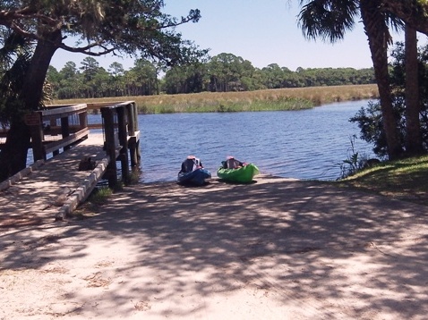
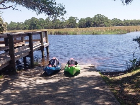
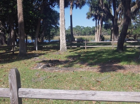
Launch at Bulow Plantation
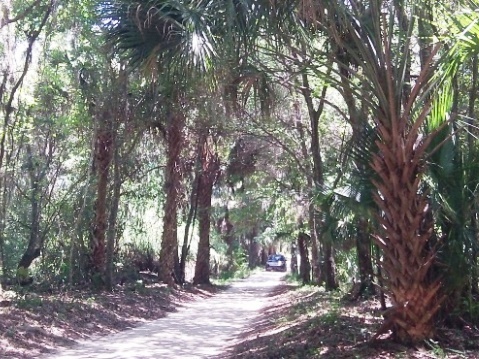
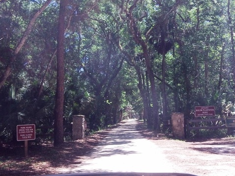
The entrance to Bulow Plantation Ruins Historic State Park is off Old Kings Highway. Directions on Google maps led us to a retirement community next door where park access is now cut off (we reported it, hopefully will be corrected). The entrance is actually a narrow, tree-lined dirt road across from a sign along the road identifying the park (an arrow pointing to the road would have been helpful). The launch / boat ramp is easy on and off.
Bulow Plantation Ruins - Upstream
We paddled from Bulow Plantation Ruins upstream about 3.5 miles until the stream narrowed and was blocked by some trees. We could have worked our way around the trees, but could see that obstacles continued to block the way. As it was getting late and the park gates are locked at 5 p.m., we decided it best to paddle back.
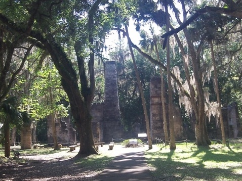
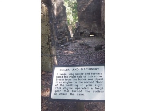
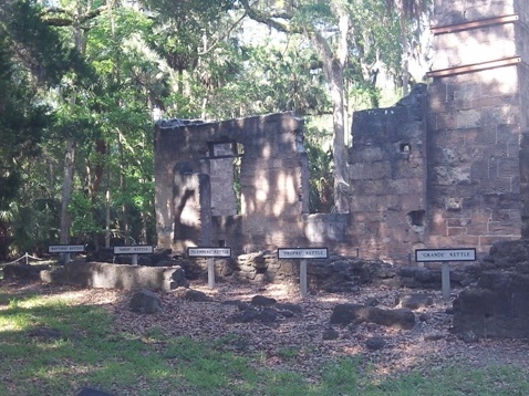
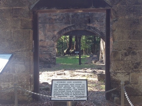
Bulow Plantation Ruins Historic State Park
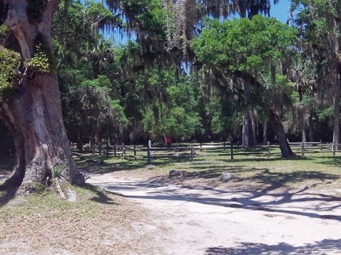
The park is one of the prettiest we've seen, and the ruins an interesting visit. In the 1800’s sugar planting and milling was introduced in Florida and the Bulow Plantation (“Bulowville”) at 2,000 acres was the largest of 12 in this area. Established by the Bulow family in 1821, the mill was burned down in 1836 during the Seminole Wars. The coquina walls of the mill, along with some peripheral buildings, remain.
More Information and Resources
Nearby Paddling:
Tomoka River Paddling Trail
See FL North Region for more paddling
Nearby Biking:
Related Resources:
Florida Office of Greenways and Trails - Bulow Creek Paddling Trail (pdf)
Florida State Parks - Bulow Plantation Ruins Historic State Park
View great paddling by FL Region or Listed A - Z

PaddleFlorida.net... Find Florida's Best Recreational Paddling,
by Kayak, Canoe, and Paddleboard too.
Copyright © PaddleFlorida.net. All Rights Reserved. Paddle Florida®