Paddle Florida®
Over 100 Florida Paddling Destinations
E-Z Maps... Photos... Reports...
You are here > Home >
West-Central FL >
Alafia River
Trip report: April 2013
Alafia River Kayaking...
Florida Paddling Trail Draped in Spanish Moss
The Alafia River starts out as the North Prong (at Mulberry) and the South Prong (at Bradley), which converge above Alderman's Ford and it eventually flows into Hillsborough Bay. The upper river is shallow, scenic and twisty. A 10-mile State Designated Paddling Trail runs between Alderman's Ford Park and Lithia Springs Conservation Park in Hillsborough County. Note: the local outfitter and other sources list the distance as 11.5 miles, which we believe is more correct. (Detailed map and photos below.)
Distance: 10 or 11.5 miles (many twists and turns) between Alderman's Ford Conservation
Park and Lithia Springs Conservation Park
Location: Hillsborough County (south of Brandon)
Difficulty: Easy to Moderate (depending on water levels, some limestone shoals)
Tidal: No
Launch points: Alderman's Ford Park (SR 39 north of Thompson Road, fee), Lithia
Springs Park (CR 60 to Lithia Springs Road, fee),
(See map)
Nearby points of interest: Alafia River State Park
Rentals/Outfitters/Tours:
Alafia River Canoe Rentals
Support and Advocacy:
Friends of Alafia
Page Summary:
- Paddling on Alafia River
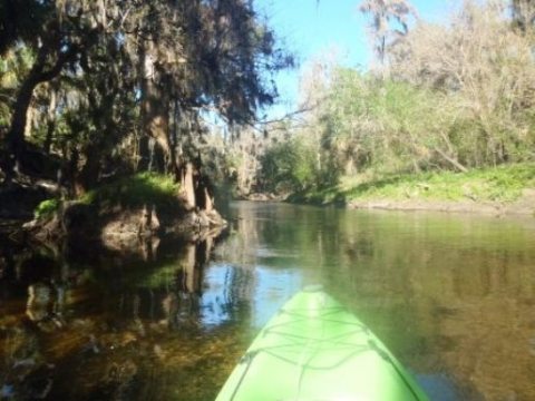
- River at Alderman's Ford Conservation Park
- Launch at the Park, Alderman's Ford Park - River at Lithia Springs Park
- Launch at the Park, Paddling Upstream, Lithia Springs Park - About the Alafia River
- More Information and Resources
Paddling on Alafia River... Comments and Photos
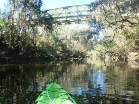
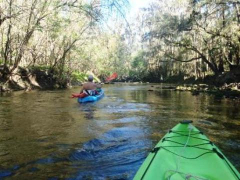
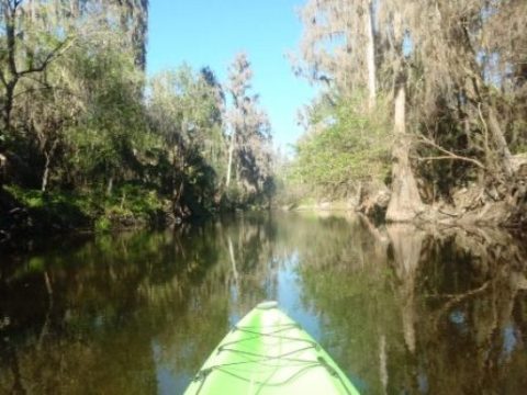
By kayak or canoe, paddling at normal water levels is generally an easy trip, though limestone rock shoals may present a few challenges (and fun). At lower levels, kayakers can expect a few scrapes, and some get out and float-over may be best. The rocks are sharp, so shoes (flip-flops or better) recommended. At high water, the swifter current can be a challenge to novice paddlers. Best at normal to low levels.
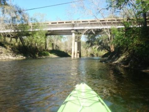
Cypress, sabal palm, oak and elm line the paddling trail providing a green canopy; for us a notable feature was the amount of Spanish moss draping the trees - a scenic ride on the twisting river. The paddling trail runs mostly through preserve and conservation areas, only a few homes are visible near the CR 640 bridge. An outfitter offers rentals and shuttle services, with drop-off at Alderman's Ford and take-out just below Lithia Springs. Shallow, sand bottom, normal current about 3 mph. Plan at least 4 hours for the full run. Another option is an up and back paddle, going upstream for whatever distance is comfortable.
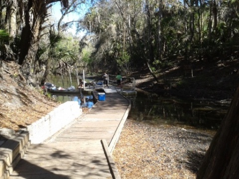
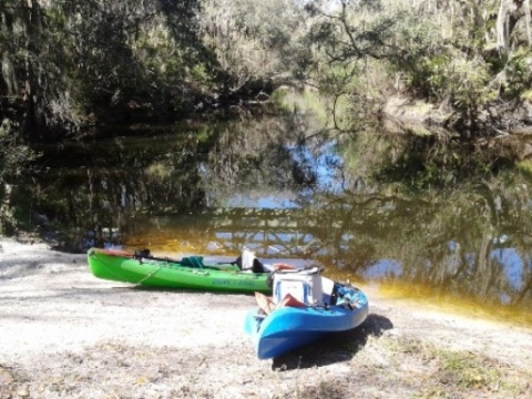
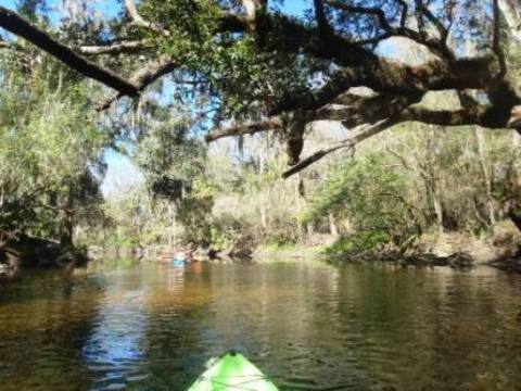
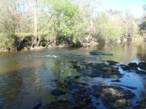
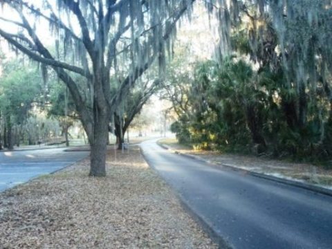
River at Alderman's Ford Park
Launch at Alderman's Ford Park
The canoe/kayak launch area is to the west on SR 39 and the Park main entrance is a little further up the road (north of the bridge over the river). The launch is on a short canal that leads to the main river, accessed by path and then down a ramp to the dock.
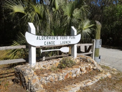
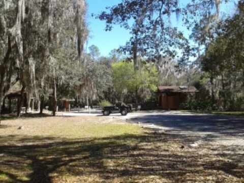
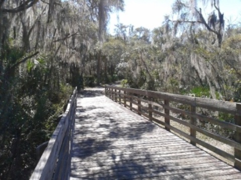
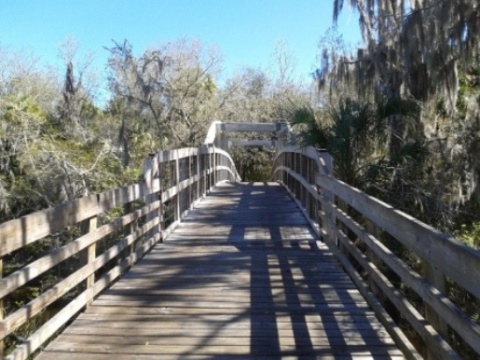
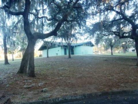
Alderman's Ford Park
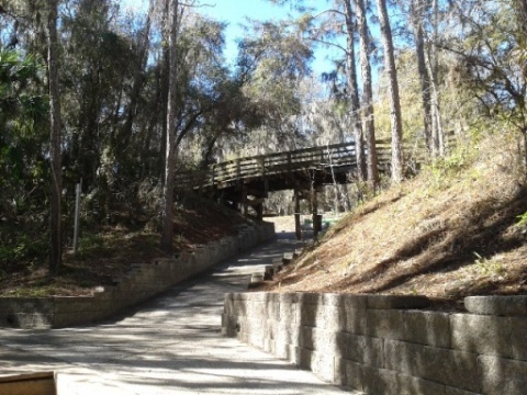
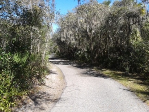
In addition to river access, Alderman's Ford Conservation Park has a visitor center, parking, restrooms, picnicking, hiking, camping, fishing. The two sections of the park are connected by a scenic 2-mile pedestrian/bike trail, including a boardwalk and views of the river. We suggest allowing some time to explore.
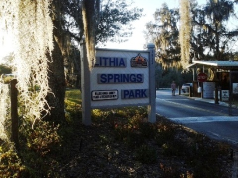
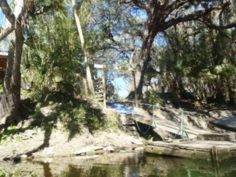
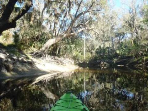
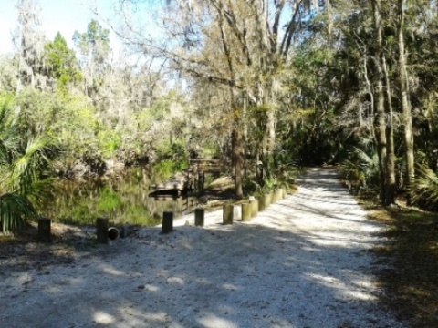
River at Lithia Springs Park
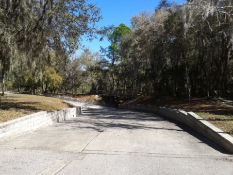
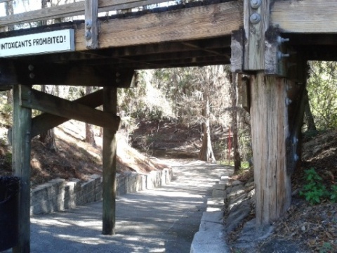
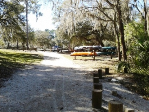
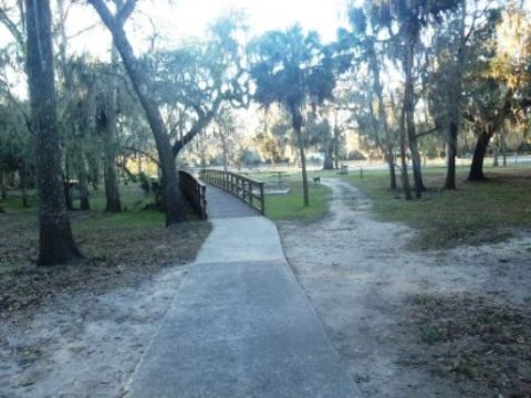
Launch at Lithia Springs Park
We launched at Lithia Springs Park and paddled upstream. It's about 150 feet from the unloading area to the launch, so we used our wheels. There's a steep grade just before the launch, so hold on!
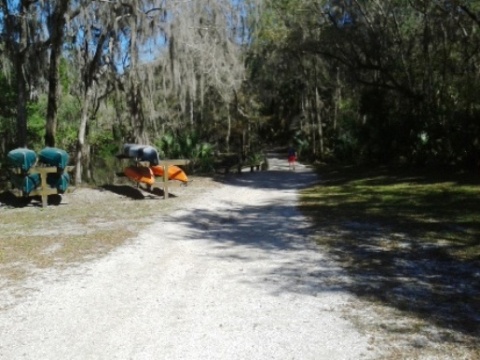
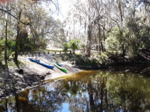
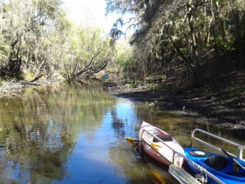
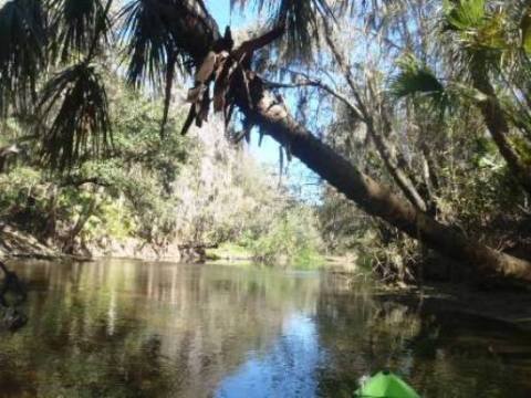
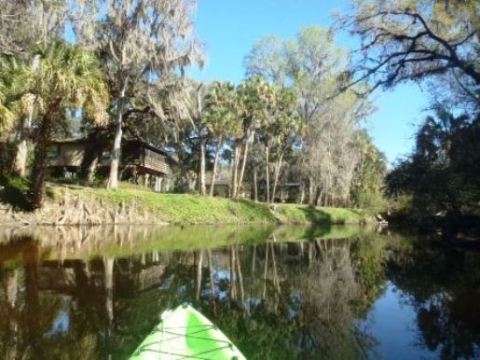
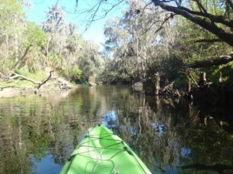
Upstream from Lithia Springs Park
From here, we paddled about 3.5 miles upstream and did a mostly leisurely float back. The current was about 3 mph, sandy bottom, clear tannin-stained water. The Spanish moss canopy made for a scenic ride. The water level was low and we ran into shoals in a few places, requiring us to step out and pull our kayaks a couple of times. No blown flip-flops on this trip, but if you're doing the full run, water shoes would be better choice.
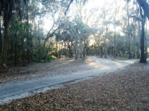
Lithia Springs Park
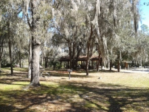
Lithia Springs Conservation Park has parking, restrooms, camping, playground, picnic, hiking, and swimming at the spring (swimming in the river is not recommended). The park can be very busy in the spring and summer. Boats are not allowed on the spring run, so if you want to swim, moor outside the markers.
About the Alafia River
Alafia is pronounced AL-uh-fi, an Indian word for "river of fire" from the flashes of light that could be seen in the water at night. These were caused by phosphorus in the water. Phosphate mining grew and now defines this part of Florida (which produces 30% of the world's phosphate).
The Alafia River has an unfortunate pollution history, and depending on who you talk to, swimming is not recommended except at Lithia Springs. Phosphate mining and agriculture have contributed, but the major damage occurred during a rainstorm in 1997 when a dam broke at the Mulberry Phosphates fertilizer plant, dumping 56 million gallons of acidic wastewater and killing everything from the North Prong of the river to the US 41 bridge. While protections have been put in place and wildlife is now making a comeback, when compared to what we have seen on the Hillsborough River and others in the region, the restoration process is still ongoing. Otherwise thanks to the preserves and conservation areas along the upper river, this is some of the most scenic paddling in Florida. Plus it's not often we Floridians get to enjoy mini-rapids.
More Information and Resources
Nearby Paddling:
See FL West-Central Region for more paddling
Nearby Biking:
Related Resources:
Florida Office of Greenways and Trails -
Alafia River Paddling Trail (.pdf)
Florida State Parks - Alafia River State Park
Hillsborough County - Alderman's Ford Conservation Park
Hillsborough County - Lithia Springs Conservation Park
View great paddling by FL Region or Listed A - Z

PaddleFlorida.net... Find Florida's Best Recreational Paddling,
by Kayak, Canoe, and Paddleboard too.
Copyright © PaddleFlorida.net. All Rights Reserved. Paddle Florida®